
Image: Map of Zahir al-Umar's domains, c. 1772
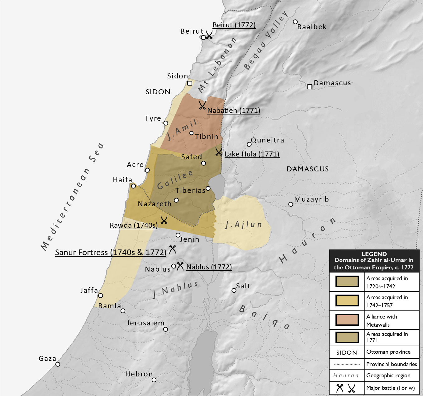
Description: Map showing the territory controlled by Zahir al-Umar, his sons, and Metawali allies in Ottoman Palestine and Lebanon around 1772. From about 1750, Zahir's capital was the port town of Acre. The different colored shades indicate general phases of expansion. Also indicated on the map are important geographic regions and towns, major battles or sieges, and approximate Ottoman provincial (eyalet) boundaries. Sources: The map is based mainly on the map found in Thomas Philipps (2001) Acre: The Rise and Fall of a Palestinian City, p. 228, with modifications, including the inclusion of Jabal Ajlun, based on information from from the same source, pp. 31-43, and/or Ahmad Joudah (2013) Revolt in Palestine in the Eighteenth Century: The Era of Shaykh Zahir al-Umar (Second ed.).
Title: Map of Zahir al-Umar's domains, c. 1772
Credit: Own work
Author: Al Ameer son
Usage Terms: Creative Commons Attribution-Share Alike 4.0
License: CC BY-SA 4.0
License Link: https://creativecommons.org/licenses/by-sa/4.0
Attribution Required?: Yes
Image usage
The following page links to this image:
