
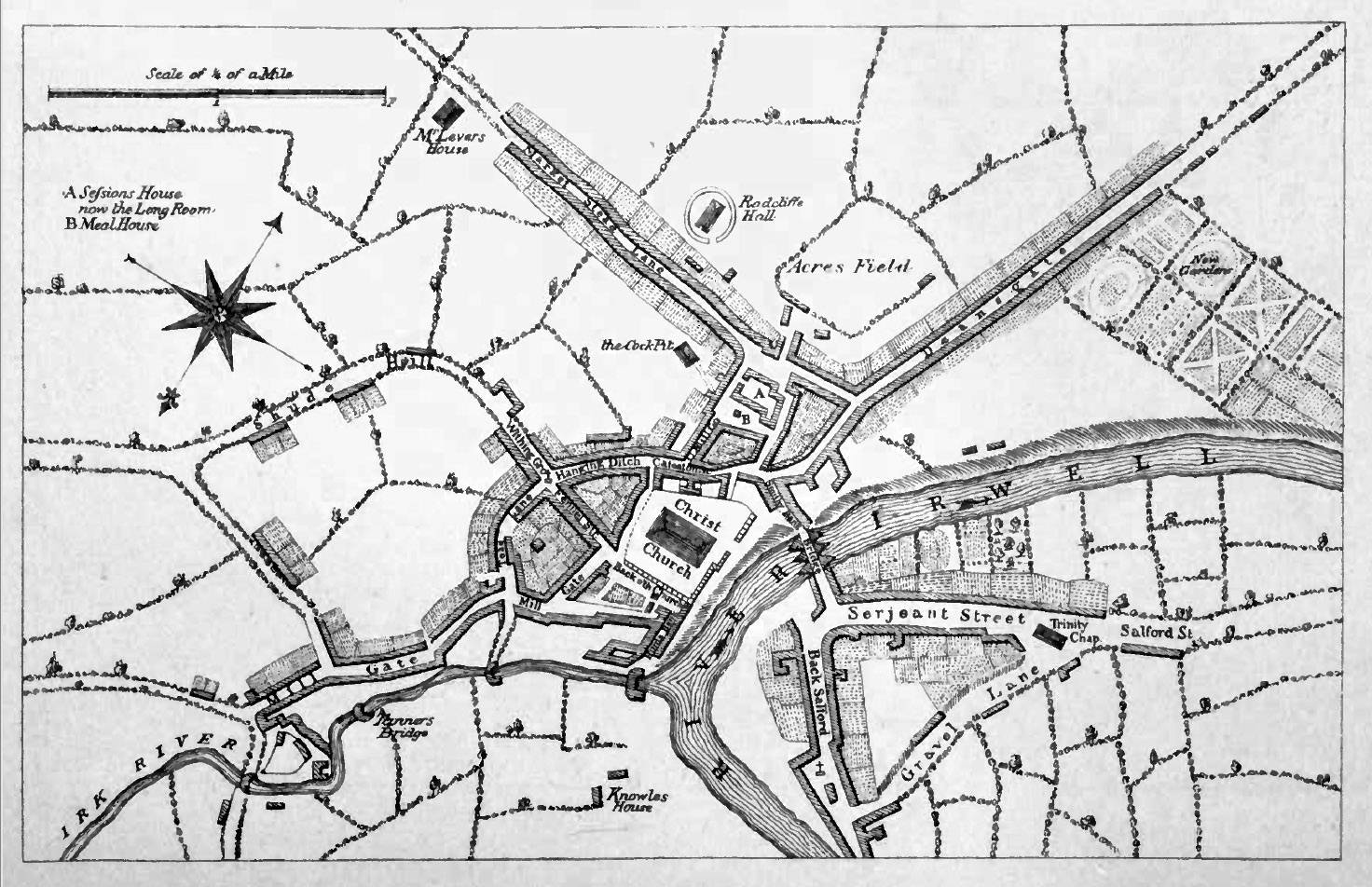
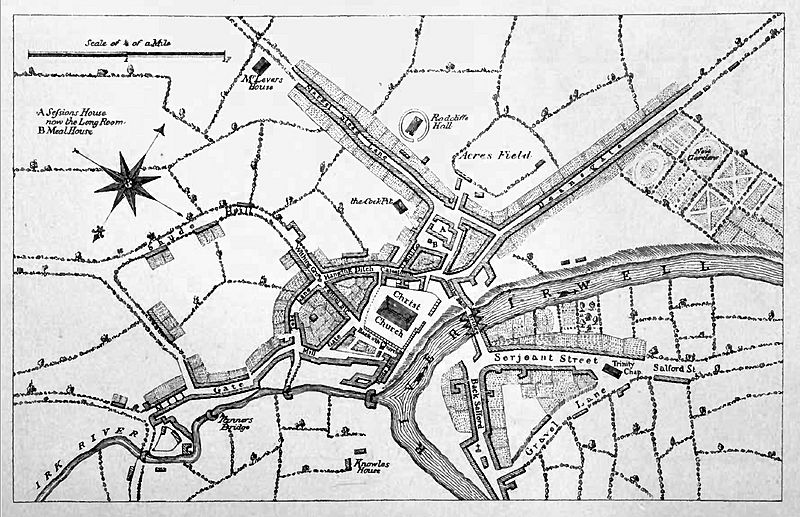
Image: Map of manchester circa 1650
Size of this preview: 800 × 517 pixels. Other resolutions: 320 × 207 pixels | 1,472 × 952 pixels.
Original image (1,472 × 952 pixels, file size: 434 KB, MIME type: image/jpeg)
Description: A map of Manchester from about 1650, from "Views of Old Manchester"
Title: Map of manchester circa 1650
Credit: http://ia340911.us.archive.org/3/items/viewsofoldmanche00manciala/viewsofoldmanche00manciala.pdf
Author: not quoted, published by Manchester : Mancunium Velveteen
Usage Terms: Public domain
License: Public domain
Attribution Required?: No
Image usage
The following page links to this image:

All content from Kiddle encyclopedia articles (including the article images and facts) can be freely used under Attribution-ShareAlike license, unless stated otherwise.