
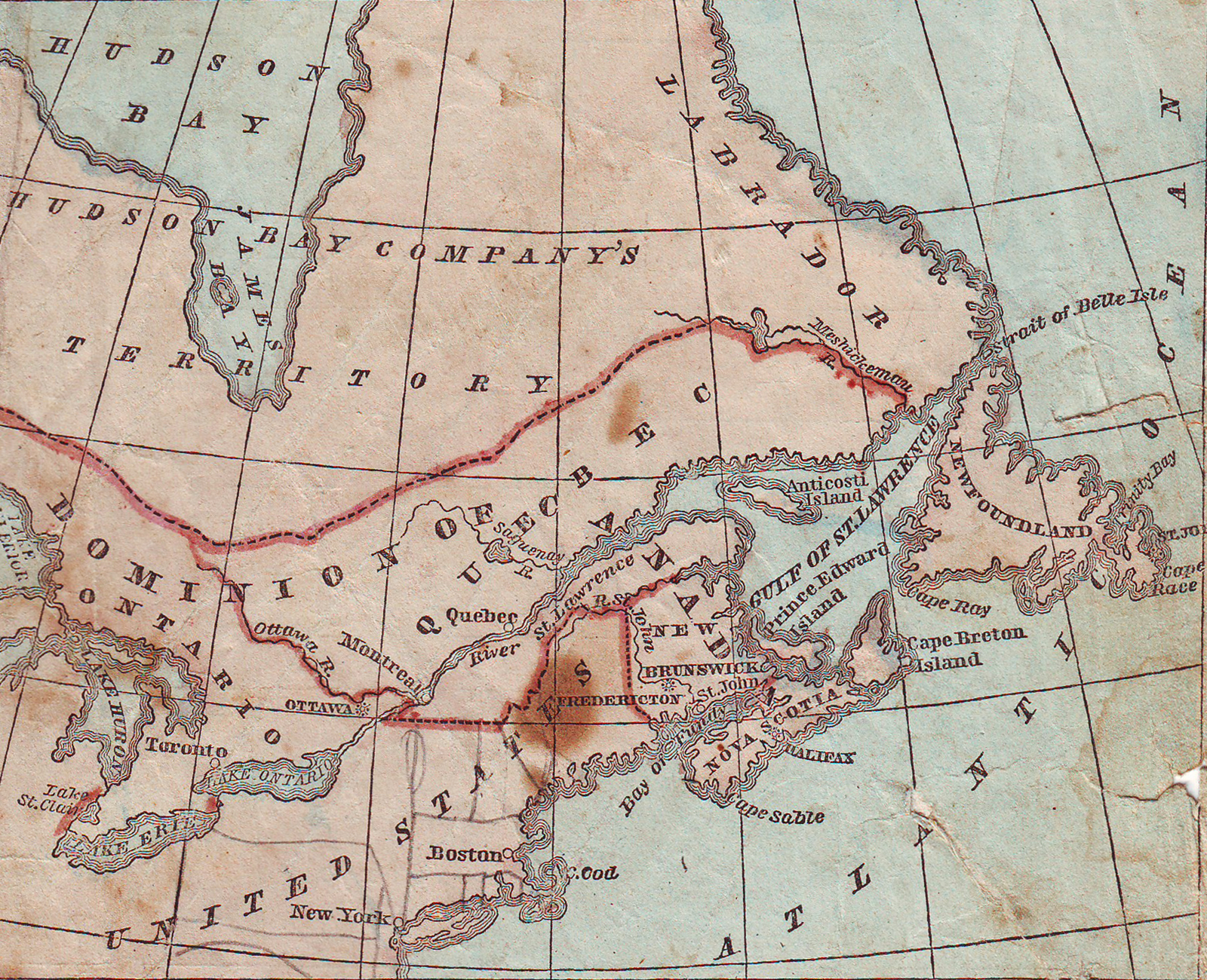
Image: Map of the Eastern British Provinces in North America at the time of Confederation 1867
Size of this preview: 738 × 600 pixels. Other resolutions: 295 × 240 pixels | 1,600 × 1,300 pixels.
Original image (1,600 × 1,300 pixels, file size: 2.56 MB, MIME type: image/jpeg)
Description: Map of the Eastern British Provinces in North America at the time of Confederation 1867
Title: Map of the Eastern British Provinces in North America at the time of Confederation 1867
Credit: Cornell, Sarah S. "Cornell's Primary Geography" (Revised Edition) p. 73 New York: D. Appleton & Co 1867 "The Cooper Collections" (uploader's private collection) Digitized by Centpacrr
Author: Sarah S. Cornell
Usage Terms: Public domain
License: Public domain
Attribution Required?: No
Image usage
The following 2 pages link to this image:

All content from Kiddle encyclopedia articles (including the article images and facts) can be freely used under Attribution-ShareAlike license, unless stated otherwise.