
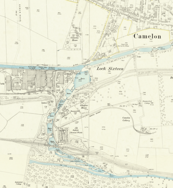
Image: Map of the Flight of locks at Falkirk

Size of this preview: 552 × 600 pixels. Other resolutions: 221 × 240 pixels | 836 × 908 pixels.
Original image (836 × 908 pixels, file size: 896 KB, MIME type: image/png)
Description: Part of OS sheet XXX.2 showing the flight of canal locks at Falkirk and a section of the Antonine Wall between Rough Castle and Camelon at a scale of 1:2,500 or about 25 inches to one mile. Second Edition, 1897
Title: Map of the Flight of locks at Falkirk
Credit: This image is available from the National Library of Scotland https://maps.nls.uk/geo/explore/side-by-side/#zoom=16&lat=55.99833&lon=-3.81570&layers=168&right=BingHyb
Author: Director General of the Ordnance Survey, UK
Usage Terms: Public domain
License: Public domain
Attribution Required?: No
Image usage
The following 2 pages link to this image:

All content from Kiddle encyclopedia articles (including the article images and facts) can be freely used under Attribution-ShareAlike license, unless stated otherwise.