
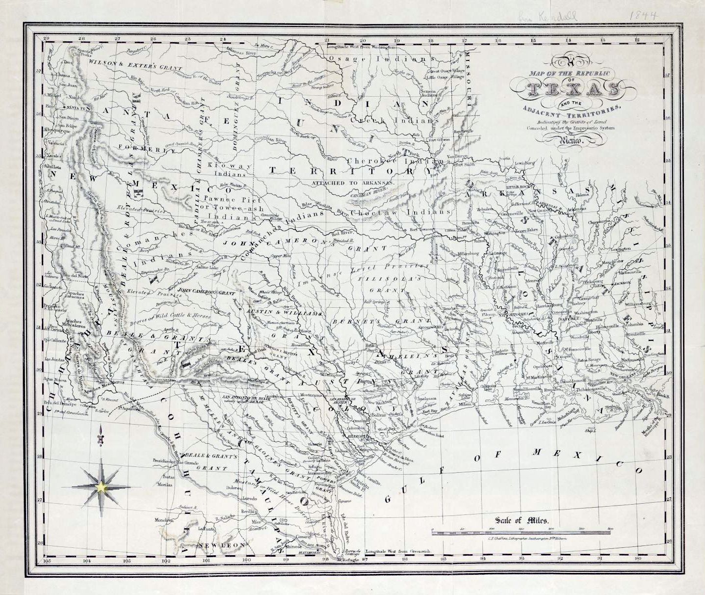
Image: Map of the Republic of Texas and the Adjacent Territories, 1841
Size of this preview: 711 × 600 pixels. Other resolutions: 285 × 240 pixels | 1,437 × 1,212 pixels.
Original image (1,437 × 1,212 pixels, file size: 458 KB, MIME type: image/jpeg)
Description: Map of the Republic of Texas and the Adjacent Territories, indicating the Grants of Land conceded under the Empresario System of Mexico by Charles F. Cheffins, 1841
Title: Map of the Republic of Texas and the Adjacent Territories, 1841
Credit: Map of the Republic of Texas and the Adjacent Territories, indicating the Grants of Land conceded under the Empresario System of Mexico, 1841 (online at http://texashistory.unt.edu/ark:/67531/metapth31849 )
Author: Charles Frederick Cheffins
Usage Terms: Public domain
License: Public domain
Attribution Required?: No
Image usage
There are no pages that link to this image.

All content from Kiddle encyclopedia articles (including the article images and facts) can be freely used under Attribution-ShareAlike license, unless stated otherwise.