
Image: Map of the San Joaquin, Sacramento and Tulare Valleys 1873
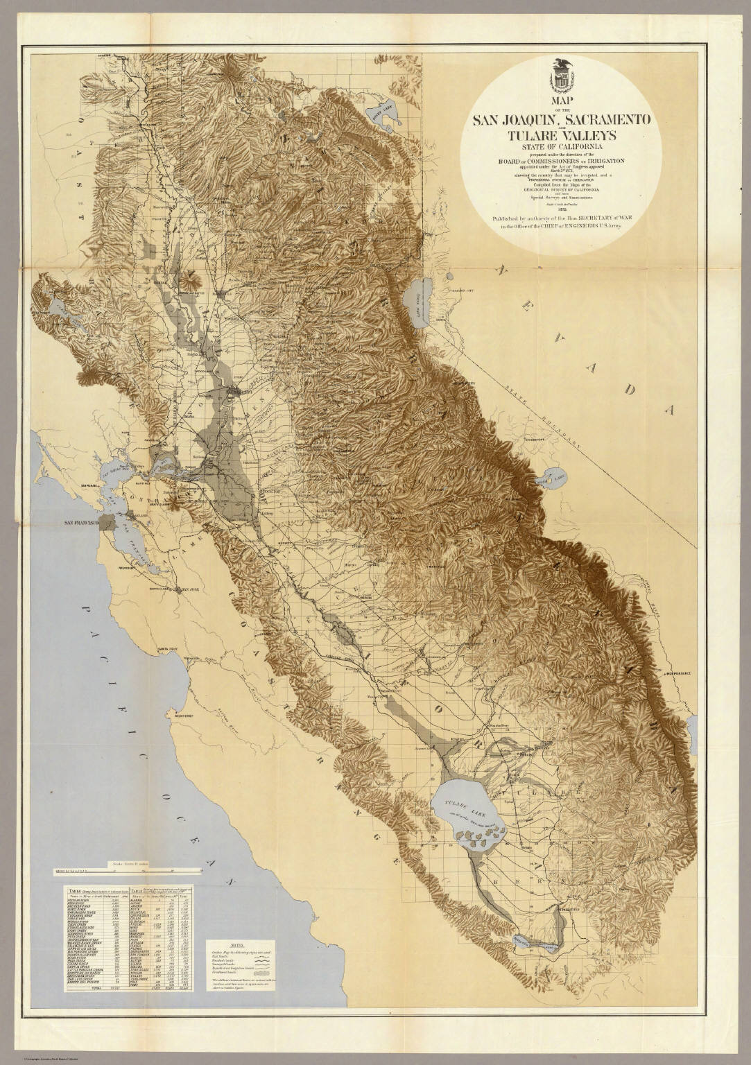
Description: "Map of San Joaquin, Sacramento and Tulare Valleys, State of California, prepared under the direction of the Board of Commissioners on Irrigation, appointed under the Act of Congress approved March 3rd 1873, showing the country that may be irrigated and a provisional system of irrigation. Compiled from the Maps of the Geological Survey of California and from Special Survey and Examinations. 1873. Published by authority of the Hon. Secretary of War in the Office of the Chief of Engineers U.S. Army."
Title: Map of the San Joaquin, Sacramento and Tulare Valleys 1873
Credit: David Rumsey Map Collection – Cartography Associates
Author: Board of Commissioners on Irrigation, California
Usage Terms: Public domain
License: Public domain
Attribution Required?: No
Image usage
The following 2 pages link to this image:
