
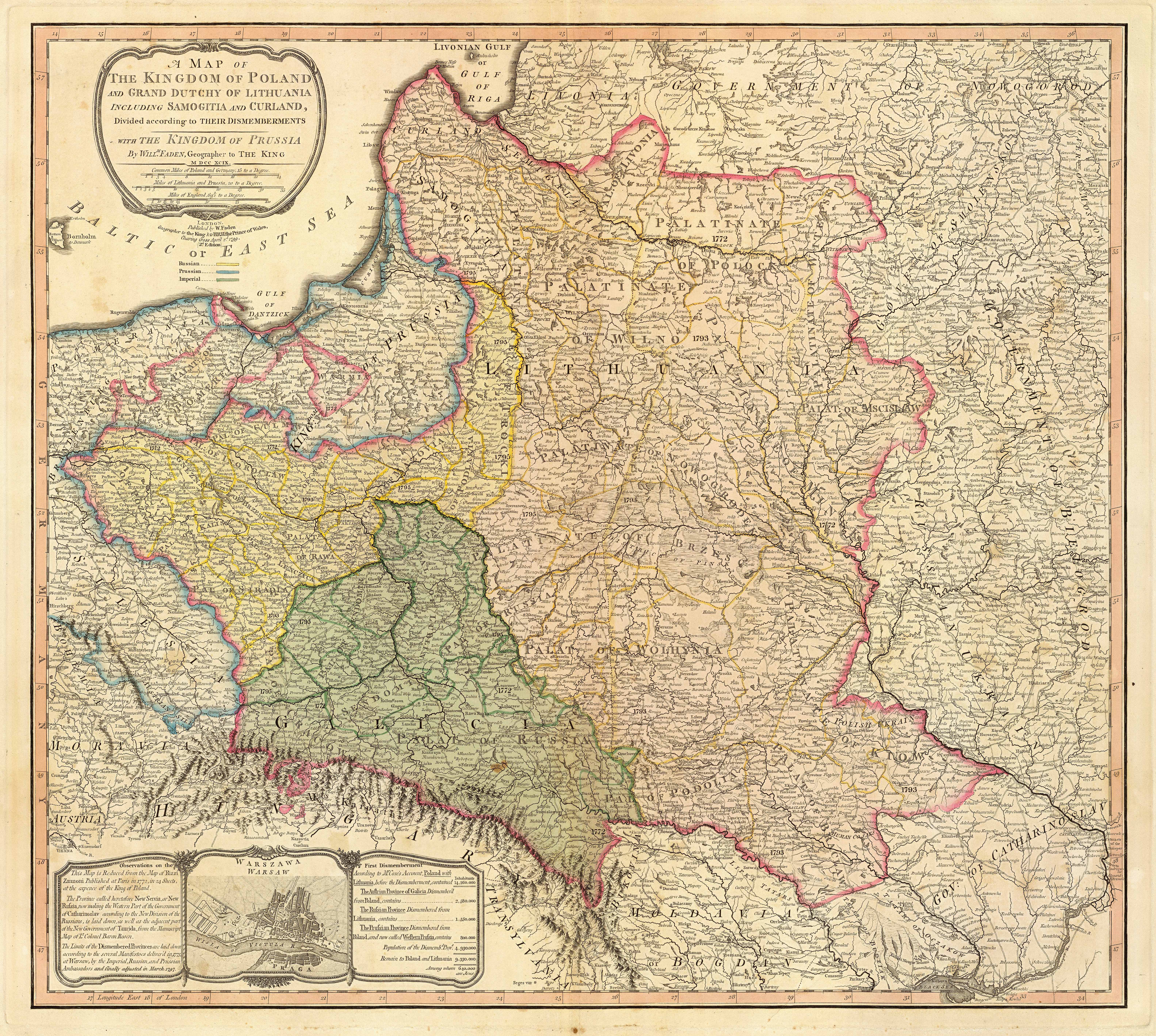
Image: Map of the partition of the Kingdom of Poland and the Grand Duchy of Lithuania from 1799
Description: Title: "A map of the Kingdom of Poland and the Grand Duchy of Lithuania including Samogitia and Curland divided according to their dismemberments with the Kingdom of Prussia". A map from 1799 showing how the Polish-Lithuanian Commonwealth was partitioned in 1765-1795 between Prussia, Austria, and Russia. This is an extremely detailed map which lists all the cities and small towns and labels the regions according to their English names. The boundaries former Polish-Lithuanian Commonwealth colored light red. The areas taken by Prussia are colored yellow, those taken by Austria colored green, and those taken by Russia are colored beige. Prussia itself is bordered in blue. Eastern Pomerania and Warmia are shown as part of Prussia but bordered in red as well.
Title: Map of the partition of the Kingdom of Poland and the Grand Duchy of Lithuania from 1799
Credit: http://www.belarusguide.com/images/maps/Kokosha/POlonia&Lituania-1799.jpg
Author: William Faden
Usage Terms: Public domain
License: Public domain
Attribution Required?: No
Image usage
There are no pages that link to this image.
