
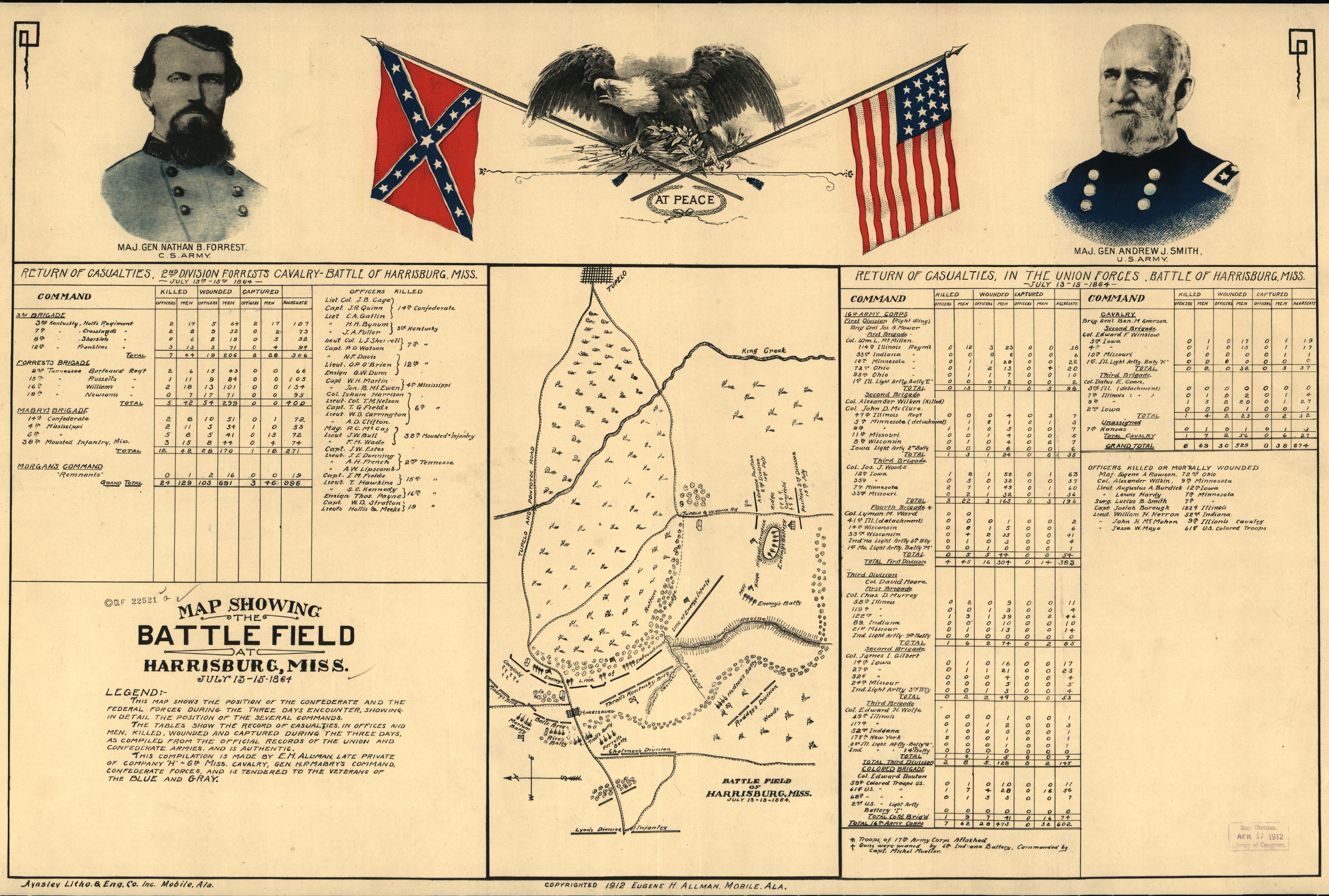
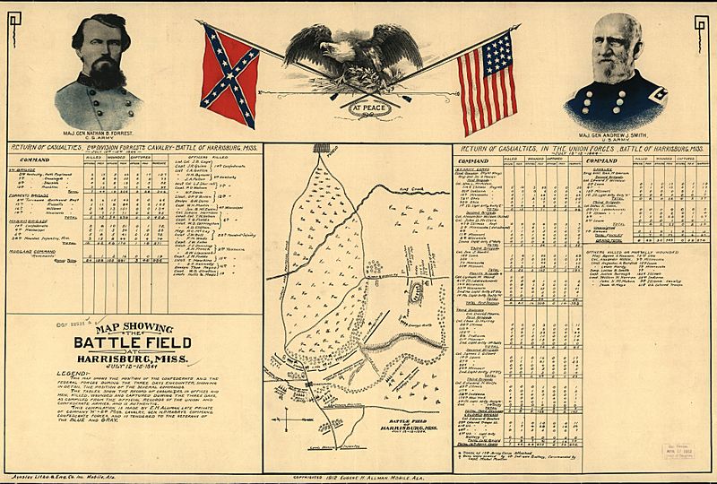
Image: Map showing the battle field at Harrisburg, Miss. July 13-15, 1864. LOC 99447417
Description: Scale not given. LC Civil War Maps (2nd ed.), 272 "Legend: This map shows the position of the Confederate and the Federal forces during the three days encounter, showing in detail the position of the several commands. "The tables show the record of casualties, in offices [sic] and men, killed, wounded and captured during the three days, as compiled from the official records of the Union and Confederate armies, and is authentic. "This compilation is made by E. H. Allman, late private of Company "H"-6th Miss. Cavalry, Gen. H. P. Mabry's command, Confederate forces, and is tendered to the veterans of the Blue and Gray." Indicates entrenchments, batteries, roads, towns, vegetation, drainage, and some relief by hachures. There are colored portraits of "Maj. Gen. Nathan B. Forrest, C.S. Army" and "Maj. Gen. Andrew J. Smith, U.S. Army" in the top margin, as well as a drawing of an eagle perched on the crossed flags of the Confederate States and United States with "at peace" printed below the flags. Description derived from published bibliography. Available also through the Library of Congress web site as raster image.
Title: Map showing the battle field at Harrisburg, Miss. July 13-15, 1864. LOC 99447417
Credit: https://www.loc.gov/item/99447417/
Author: Allman, Eugene H.
Permission: This map is available from the United States Library of Congress's Geography & Map Division under the digital ID g3984h.cw0272000. This tag does not indicate the copyright status of the attached work. A normal copyright tag is still required. See Commons:Licensing for more information.
Usage Terms: Public domain
License: Public domain
Attribution Required?: No
Image usage
The following page links to this image:
