
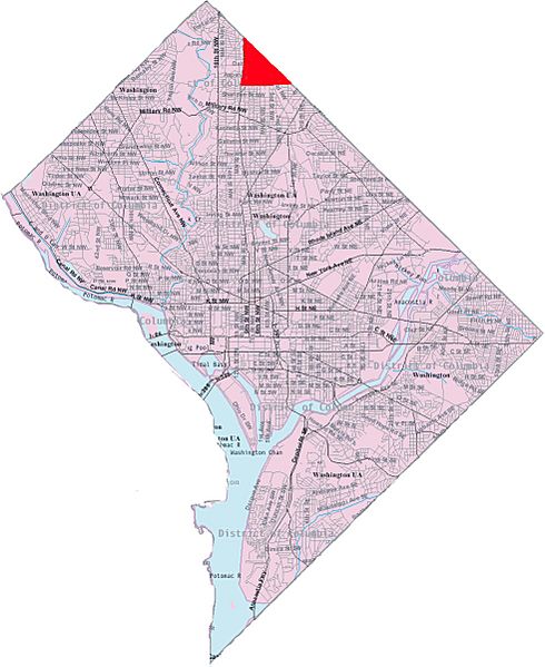
Image: Map takoma

Size of this preview: 490 × 599 pixels. Other resolutions: 196 × 240 pixels | 1,961 × 2,397 pixels.
Original image (1,961 × 2,397 pixels, file size: 1.53 MB, MIME type: image/jpeg)
Description: This image is a modified version of a self-generated reference map from the U.S. Census Bureau's American Factfinder at http://factfinder.census.gov/
Title: Map takoma
Credit: This image is a modified version of a self-generated reference map from the U.S. Census Bureau's American Factfinder at http://factfinder.census.gov/
Author: This image is a work of a United States Census Bureau employee, taken or made as part of that person's official duties. As a work of the U.S. federal government, the image is in the public domain. Subject to disclaimers.
Usage Terms: Public domain
License: Public domain
Attribution Required?: No
Image usage
The following 2 pages link to this image:

All content from Kiddle encyclopedia articles (including the article images and facts) can be freely used under Attribution-ShareAlike license, unless stated otherwise.