
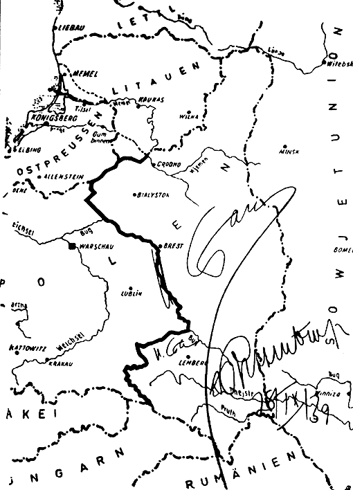
Image: Mapa 2 paktu Ribbentrop-Mołotow
Size of this preview: 432 × 600 pixels. Other resolutions: 173 × 240 pixels | 510 × 708 pixels.
Original image (510 × 708 pixels, file size: 22 KB, MIME type: image/gif)
Description: The map from the en:German–Soviet Treaty of Friendship, Cooperation and Demarcation showing the new German-Soviet border. The map is signed by Joseph Stalin and German Foreign Minister Joachim von Ribbentrop.
Title: Mapa 2 paktu Ribbentrop-Mołotow
Credit: This photo of the document was made in 1946 by the defence of von Ribbentrop and Hermann Göring in the Nuremberg Trials in 1946.
Author: Unknown
Permission: Public domain
Usage Terms: Public domain
License: Public domain
Attribution Required?: No
Image usage
The following 3 pages link to this image:

All content from Kiddle encyclopedia articles (including the article images and facts) can be freely used under Attribution-ShareAlike license, unless stated otherwise.