
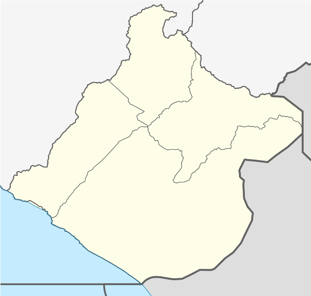
Image: Mapa de localización Tacna

Size of this PNG preview of this SVG file: 630 × 599 pixels. Other resolution: 252 × 240 pixels.
Original image (SVG file, nominally 879 × 836 pixels, file size: 617 KB)
Description: Blank political map of en:Department of Tacna. Equirectangular projection, Geographic limits of the map: N: 16.74701388888889°S S: 18.416566999999997° S W: 69.42120833333331° W E: 71.17642799999999° W
Title: Mapa de localización Tacna
Credit: OpenStreetMap.org es:AutoCAD for region´s map bounds This W3C-unspecified vector image was created with Adobe Illustrator. This W3C-unspecified vector image was created with Inkscape . Own work
Author: Waterloo1883
Usage Terms: Creative Commons Attribution-Share Alike 4.0
License: CC BY-SA 4.0
License Link: https://creativecommons.org/licenses/by-sa/4.0
Attribution Required?: Yes
Image usage
The following 2 pages link to this image:

All content from Kiddle encyclopedia articles (including the article images and facts) can be freely used under Attribution-ShareAlike license, unless stated otherwise.