
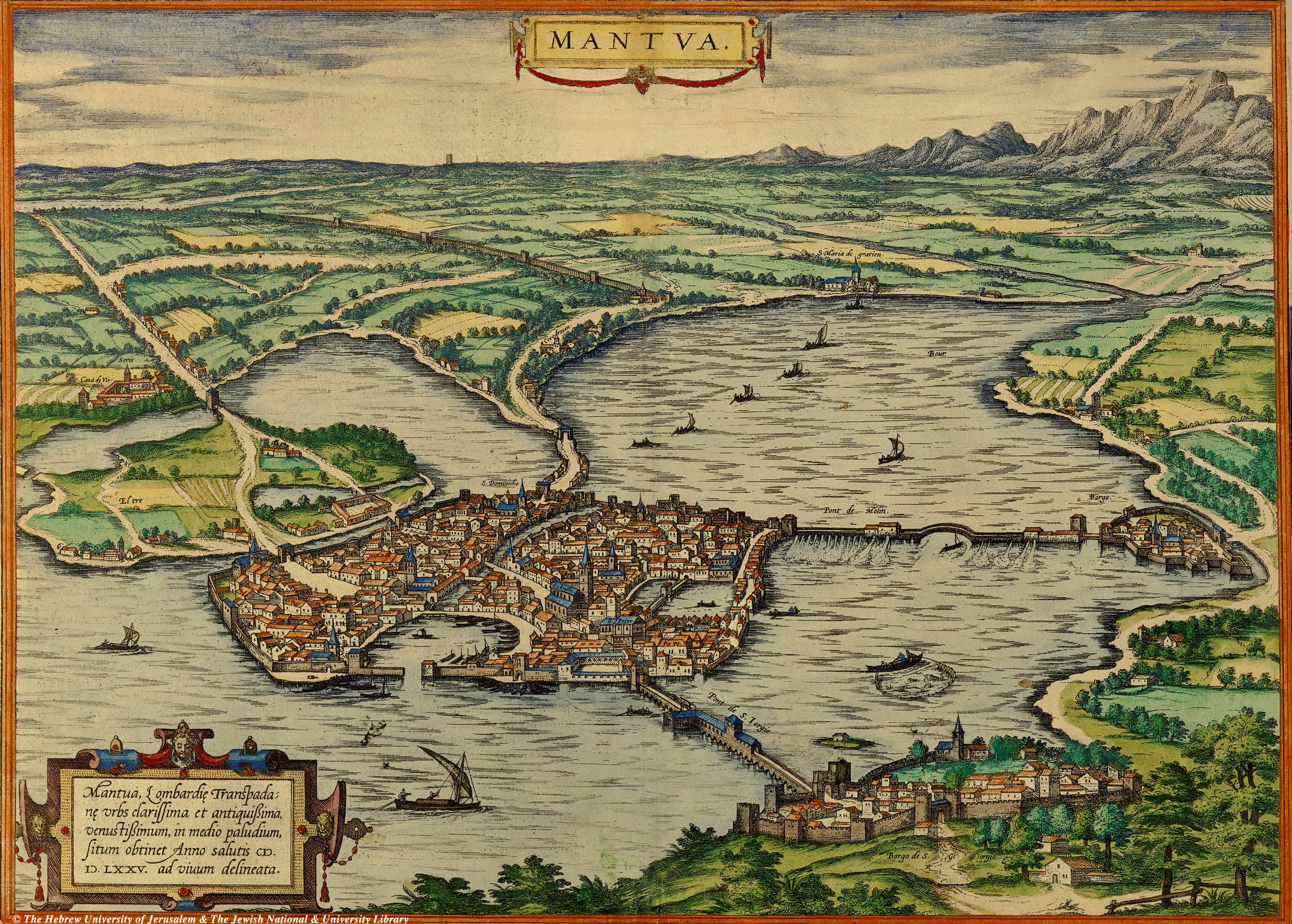
Image: Mappa del Ducato di Mantova nel 1575
Size of this preview: 800 × 572 pixels. Other resolutions: 320 × 229 pixels | 2,953 × 2,113 pixels.
Original image (2,953 × 2,113 pixels, file size: 1.66 MB, MIME type: image/jpeg)
Description: Bird-eye view of Mantua, from Civitates Orbis Terrarum, vol. II, 50, published 1575, Edited by Georg Braun and engraved by Franz Hogenberg.
Title: Mappa del Ducato di Mantova nel 1575
Credit: Braun and Hogenberg, Civitates Orbis Terrarum, vol. II, 50, 1575. Digital version obtained from The Hebrew University of Jerusalem & The Jewish National & University Library, Online: The National Library of Israel, System Number 002370031
Author: Frans Hogenberg (before 1540–1590)
Usage Terms: Public domain
License: Public domain
Attribution Required?: No
Image usage
The following page links to this image:

All content from Kiddle encyclopedia articles (including the article images and facts) can be freely used under Attribution-ShareAlike license, unless stated otherwise.