
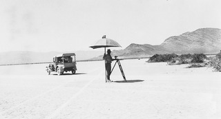
Image: Mapping the North Half of Lovelock One Degree Quadrangle in the Desert Area Near Jungo, Nevada, 1 August 1931f

Size of this JPG preview of this TIF file: 800 × 433 pixels. Other resolution: 320 × 173 pixels.
Original image (1,217 × 659 pixels, file size: 791 KB, MIME type: image/tiff)
Description: This image was downloaded from the United States Geological Survey (USGS) website at http://online.wr.usgs.gov/outreach/historicPhotos/enlarged/jungo_nevada.html. The image was captioned: "1931-Mapping the north half of the Lovelock 1° quadrangle in the desert area near Jungo, Nevada. August. "
Title: Mapping the North Half of Lovelock One Degree Quadrangle in the Desert Area Near Jungo, Nevada, 1 August 1931
Credit: http://online.wr.usgs.gov/outreach/historicPhotos/enlarged/jungo_nevada.html
Author: United States Geological Survey
Usage Terms: Public domain
License: Public domain
Attribution Required?: No
Image usage
The following 2 pages link to this image:

All content from Kiddle encyclopedia articles (including the article images and facts) can be freely used under Attribution-ShareAlike license, unless stated otherwise.