
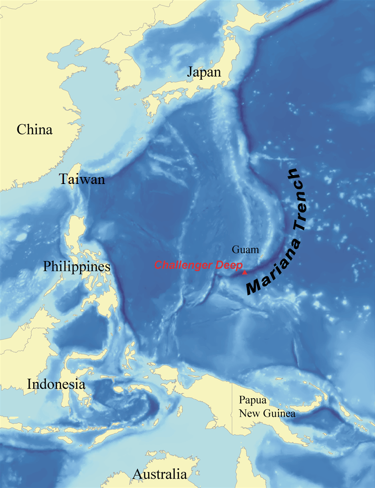
Image: Marianatrenchmap
Size of this preview: 460 × 599 pixels. Other resolutions: 184 × 240 pixels | 756 × 985 pixels.
Original image (756 × 985 pixels, file size: 604 KB, MIME type: image/png)
Description: Map showing the location of the Mariana Trench, designed as a replacement for en:Image:Mariana_trench_location.jpg.
Title: Marianatrenchmap
Credit: self-made using data from NOAA.
Author: wallace
Usage Terms: Creative Commons Attribution 2.5
License: CC BY 2.5
License Link: http://creativecommons.org/licenses/by/2.5
Attribution Required?: Yes
Image usage
The following 3 pages link to this image:

All content from Kiddle encyclopedia articles (including the article images and facts) can be freely used under Attribution-ShareAlike license, unless stated otherwise.