
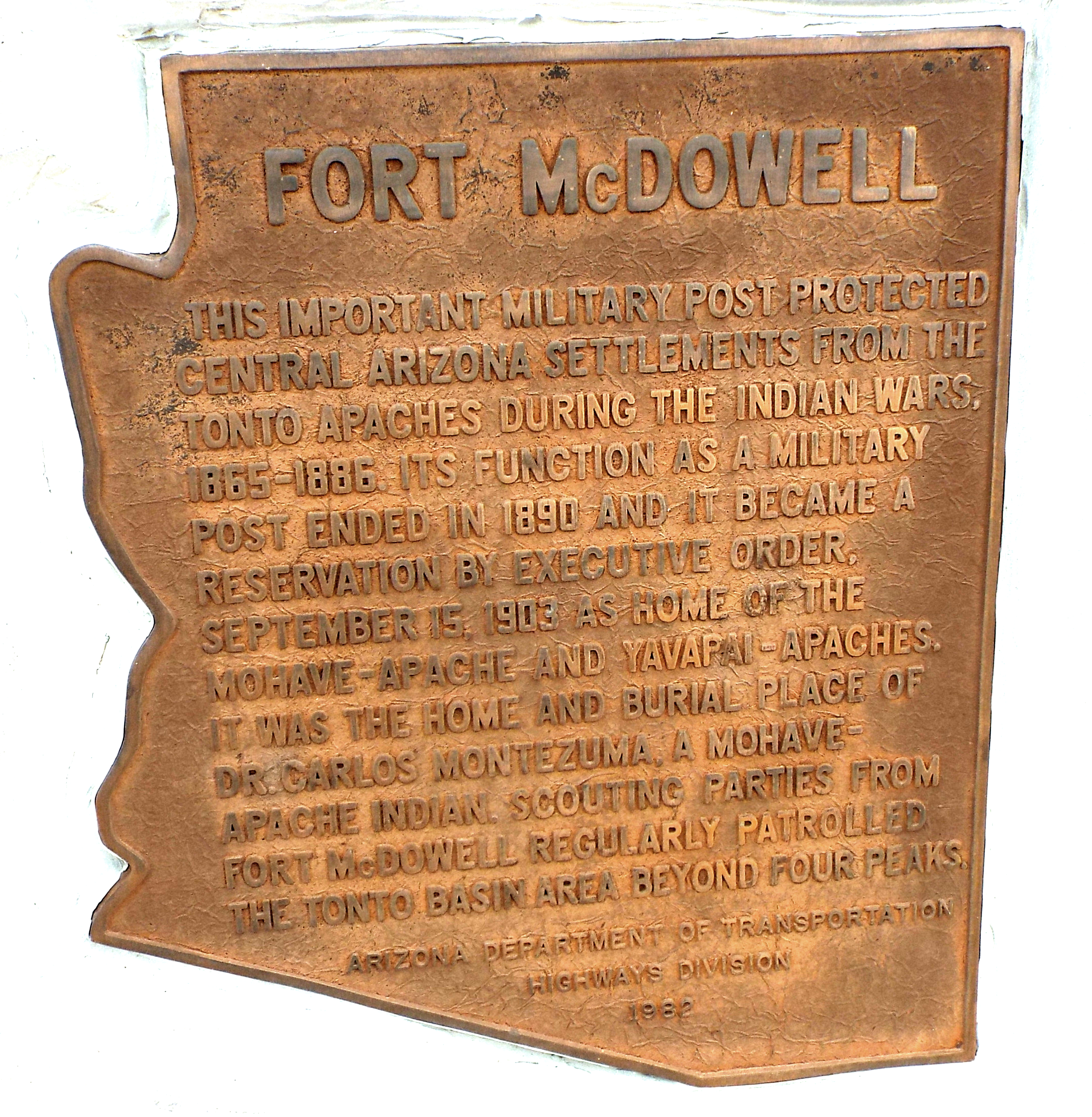
Image: Maricopa County-Fort McDowell Marker-2
Size of this preview: 586 × 599 pixels. Other resolutions: 235 × 240 pixels | 4,280 × 4,376 pixels.
Original image (4,280 × 4,376 pixels, file size: 7.2 MB, MIME type: image/jpeg)
Description: Marker which indicates where the historical Fort McDowell of Arizona was once located.
Title: Maricopa County-Fort McDowell Marker-2
Credit: Own work
Author: Marine 69-71
Usage Terms: Public domain
License: Public domain
Attribution Required?: No
Image usage
The following page links to this image:

All content from Kiddle encyclopedia articles (including the article images and facts) can be freely used under Attribution-ShareAlike license, unless stated otherwise.