
Image: Mecklenburg-Vorpommern Map Districts Border Mecklenburg Western Pomerania - Landkreise Grenzen Karte MV MeckPomm

Size of this PNG preview of this SVG file: 800 × 549 pixels. Other resolution: 320 × 220 pixels.
Original image (SVG file, nominally 1,129 × 775 pixels, file size: 759 KB)
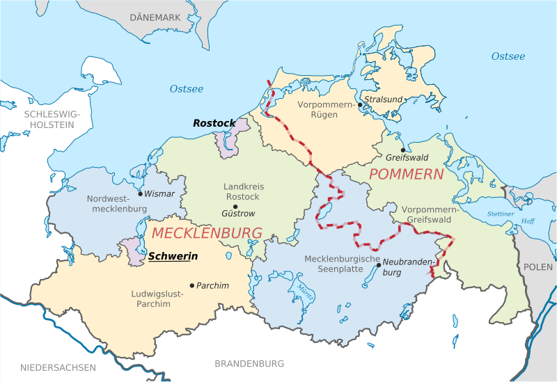
Description: Locator map of counties and their seats in Mecklenburg-Vorpommern, Germany after county reorganization 2011. The red-white line indicates the former border between the state of Mecklenburg and the Prussian province of Pommerania.
Title: Mecklenburg-Vorpommern Map Districts Border Mecklenburg Western Pomerania - Landkreise Grenzen Karte MV MeckPomm
Credit: File:Mecklenburg-Vorpommern districts 2011 colored labeled Meck-Pomm-border.svg
Author: TUBS
Usage Terms: Public domain
License: Public domain
Attribution Required?: No
Image usage
The following page links to this image:

All content from Kiddle encyclopedia articles (including the article images and facts) can be freely used under Attribution-ShareAlike license, unless stated otherwise.