
Image: MedwayHoo4181
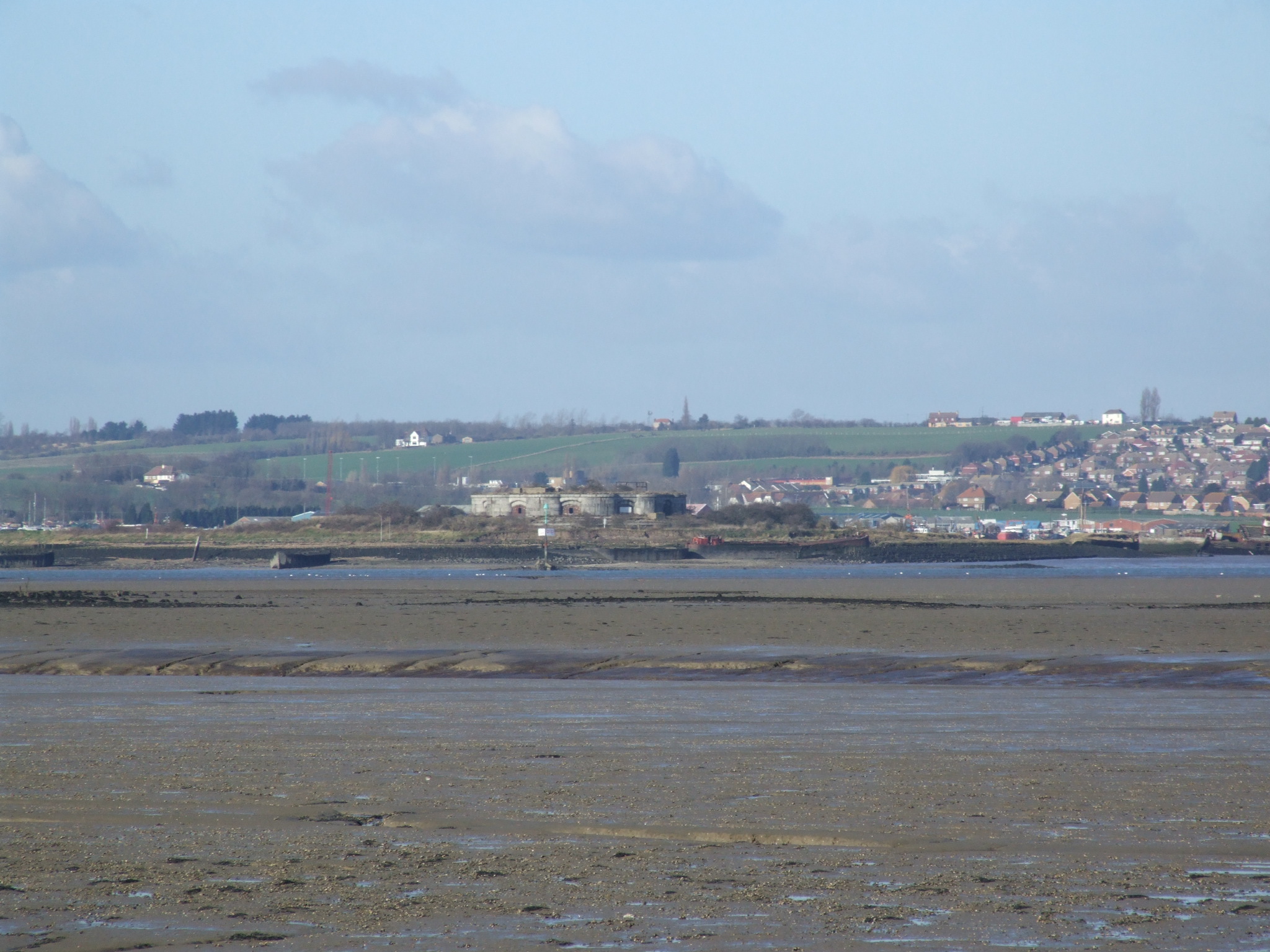
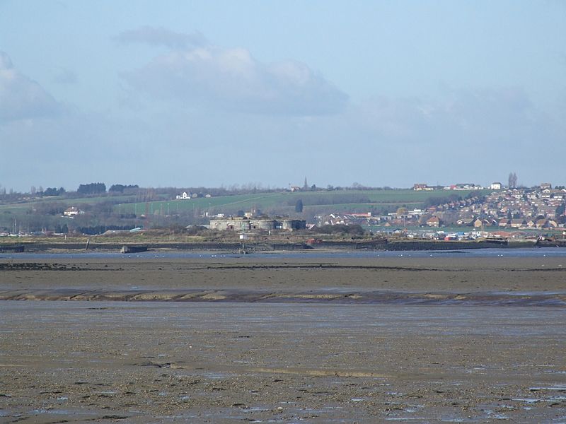
Description: Hoo Fort on the Hoo salt marsh in the Medway estuary in Kent, United Kingdom. It was one of the Palmerston forts, forming the outer ring of defences for Chatham Dockyard. Behind we can see Hoo St Werburgh. Camera location 51° 23′ 26.52″ N, 0° 36′ 07.2″ E View this and other nearby images on: OpenStreetMap - Google Earth 51.390700; 0.602000
Title: MedwayHoo4181
Credit: Own work
Author: Clem Rutter, Rochester Kent
Permission: Own work, copyleft: Multi-license with GFDL and Creative Commons CC-BY-SA-2.5 and older versions (2.0 and 1.0)
Usage Terms: Creative Commons Attribution-Share Alike 3.0
License: CC-BY-SA-3.0
License Link: http://creativecommons.org/licenses/by-sa/3.0/
Attribution Required?: Yes
Image usage
The following page links to this image:
