
Image: MiG Alley Map
No higher resolution available.
MiG_Alley_Map.JPG (348 × 375 pixels, file size: 52 KB, MIME type: image/jpeg)
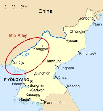
Description: The area called "MiG Alley" during the Korean War (1950-53) on the Chinese-North Korean border.
Title: MiG Alley Map
Credit: Own work based on CIA Factbook map on North Korea
Author: Triggerhappy
Usage Terms: Public domain
License: Public domain
Attribution Required?: No
Image usage
There are no pages that link to this image.

All content from Kiddle encyclopedia articles (including the article images and facts) can be freely used under Attribution-ShareAlike license, unless stated otherwise.