
Image: Michigan's Indian trails

Size of this preview: 520 × 599 pixels. Other resolutions: 208 × 240 pixels | 629 × 725 pixels.
Original image (629 × 725 pixels, file size: 183 KB, MIME type: image/png)
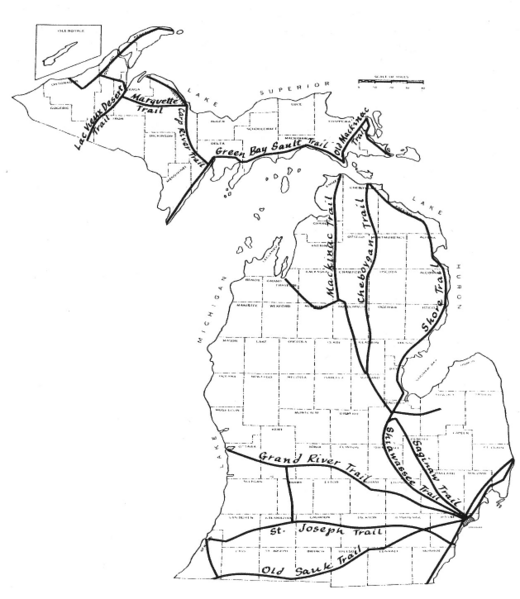
Description: Map of the Indian trails across what is now the State of Michigan before statehood
Title: Michigan's Indian trails
Credit: Mason, Philip P. (1959). Michigan Highways From Indian Trails to Expressways. Ann Arbor, MI: Braun-Brumfield. p. 18. OCLC 23314983
Author: Phillip P. Mason
Usage Terms: Public domain
License: Public domain
Attribution Required?: No
Image usage
The following 4 pages link to this image:

All content from Kiddle encyclopedia articles (including the article images and facts) can be freely used under Attribution-ShareAlike license, unless stated otherwise.