
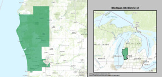
Image: Michigan US Congressional District 2 (since 2013)

Size of this JPG preview of this TIF file: 800 × 382 pixels. Other resolution: 320 × 153 pixels.
Original image (2,110 × 1,008 pixels, file size: 2.63 MB, MIME type: image/tiff)
Description: Boundaries for Michigan’s 2nd United States Federal Congressional District.
Title: Michigan US Congressional District 2 (since 2013)
Credit: GIS shapefile data created by the United States Department of the Interior, as part of the "1 Million Scale" geospatial data project. Retrieved from: http://nationalatlas.gov/atlasftp-1m.html?openChapters=#chpbound
Author: 1: GIS (congressional districts, 2013) shapefile data was created by the United States Department of the Interior. 2: Data was rendered using ArcGIS® software by Esri. 3: File developed for use on Wikipedia and elsewhere by 7partparadigm.
Usage Terms: Public domain
License: Public domain
Attribution Required?: No
Image usage
The following page links to this image:

All content from Kiddle encyclopedia articles (including the article images and facts) can be freely used under Attribution-ShareAlike license, unless stated otherwise.