
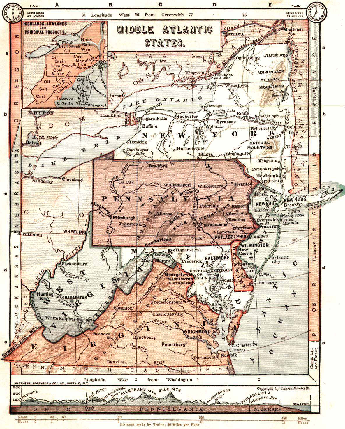
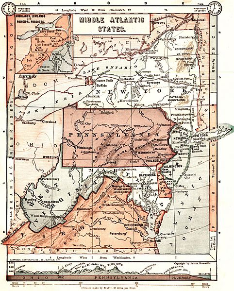
Image: Middle Atlantic States - 1883 Monteith map
Size of this preview: 482 × 599 pixels. Other resolutions: 193 × 240 pixels | 1,184 × 1,472 pixels.
Original image (1,184 × 1,472 pixels, file size: 1.73 MB, MIME type: image/jpeg)
Description: Map shows Middle Atlantic states of New York, New Jersey, Pennsylvania, Maryland, Delaware, Virginia and West Virginia, and the District of Columbia.
Title: Middle Atlantic States - 1883 Monteith map
Credit: Elementary Geography Transferred from en.wikipedia to Commons by User:LtPowers using CommonsHelper.
Author: James Monteith
Usage Terms: Public domain
License: Public domain
Attribution Required?: No
Image usage
The following 2 pages link to this image:

All content from Kiddle encyclopedia articles (including the article images and facts) can be freely used under Attribution-ShareAlike license, unless stated otherwise.