
Image: Missouririvermap

Size of this preview: 748 × 600 pixels. Other resolutions: 299 × 240 pixels | 934 × 749 pixels.
Original image (934 × 749 pixels, file size: 665 KB, MIME type: image/jpeg)
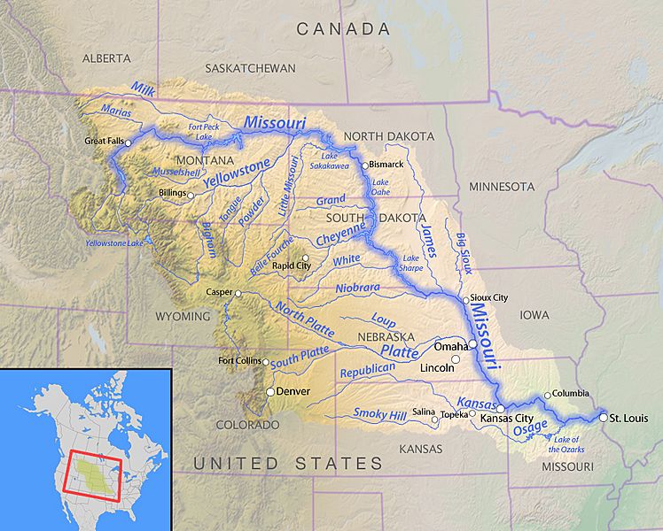
Description: Map of the Missouri River watershed — with tributaries and states labelled.
Title: Missouririvermap
Credit: Background and river course data from http://www2.demis.nl/mapserver/mapper.asp, state borders from USGS Seamless server
Author: Background layer attributed to DEMIS Mapserver, map created by Shannon1
Usage Terms: GNU Free Documentation License
License: GFDL
License Link: http://www.gnu.org/copyleft/fdl.html
Attribution Required?: Yes
Image usage
There are no pages that link to this image.

All content from Kiddle encyclopedia articles (including the article images and facts) can be freely used under Attribution-ShareAlike license, unless stated otherwise.