
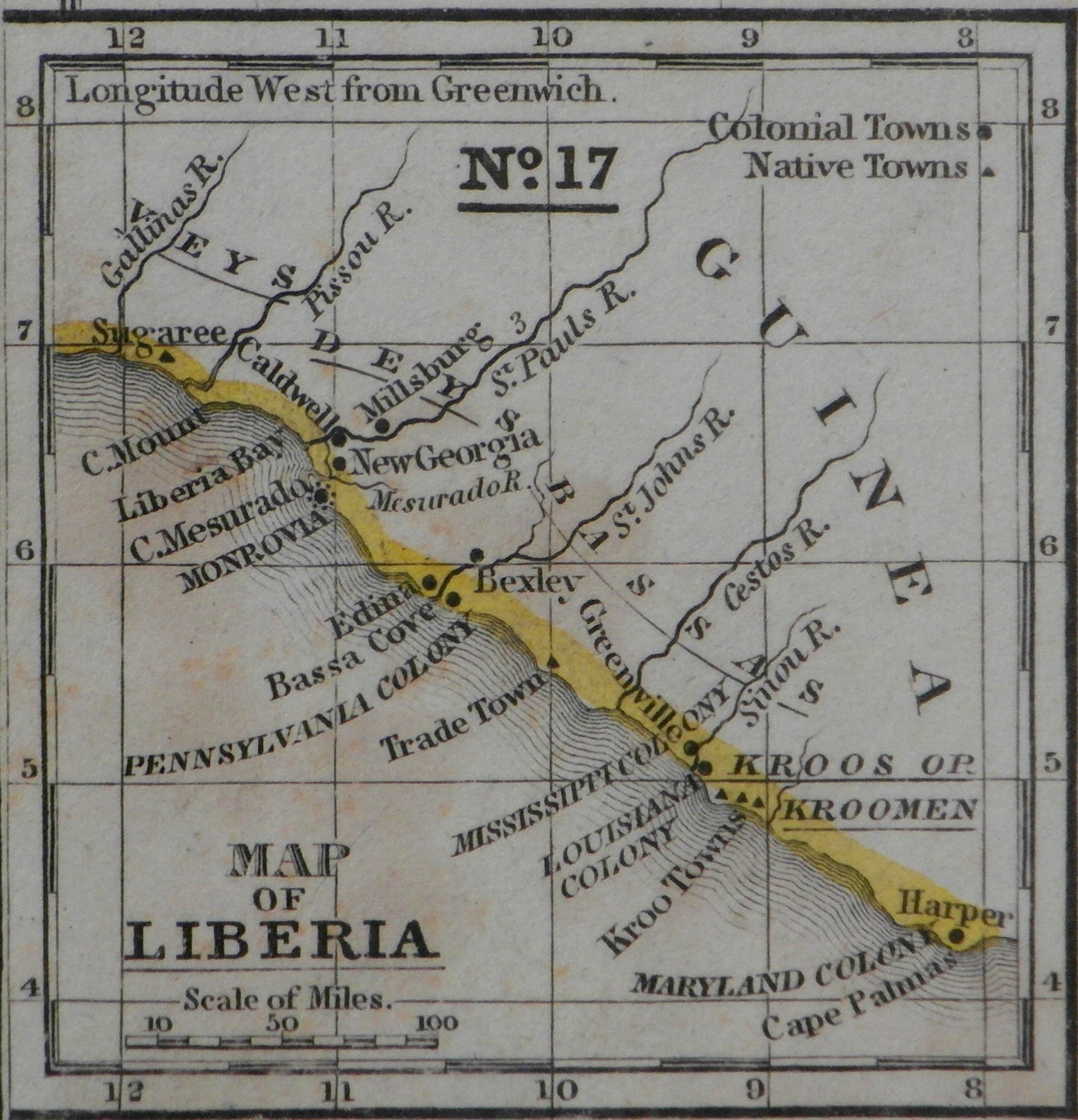
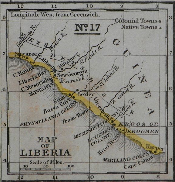
Image: Mitchell Map Liberia colony 1839
Size of this preview: 577 × 599 pixels. Other resolutions: 231 × 240 pixels | 1,678 × 1,743 pixels.
Original image (1,678 × 1,743 pixels, file size: 2.35 MB, MIME type: image/jpeg)
Description: The map presented is taken from ‘A Map of Africa’ where it is shown as an inset in the left bottom corner. In the right top corner of the map is stated: "No. 16. Map of Africa. Engraved to illustrate Mitchell’s School and Family Geography.” Below the map is written: "Entered according to Act of Congress, in the year 1839, by S. Augustus Mitchell, in the Clerk’s Office of the District Court of Connecticut.”
Title: Mitchell Map Liberia colony 1839
Credit: Own work
Author: Fred van der Kraaij
Usage Terms: Creative Commons Attribution-Share Alike 4.0
License: CC BY-SA 4.0
License Link: http://creativecommons.org/licenses/by-sa/4.0
Attribution Required?: Yes
Image usage
The following 8 pages link to this image:

All content from Kiddle encyclopedia articles (including the article images and facts) can be freely used under Attribution-ShareAlike license, unless stated otherwise.