
Image: Moel yr Ogof, Moel Lefn, and the Nantlle Ridge - geograph.org.uk - 72485
No higher resolution available.
Moel_yr_Ogof,_Moel_Lefn,_and_the_Nantlle_Ridge_-_geograph.org.uk_-_72485.jpg (640 × 480 pixels, file size: 96 KB, MIME type: image/jpeg)
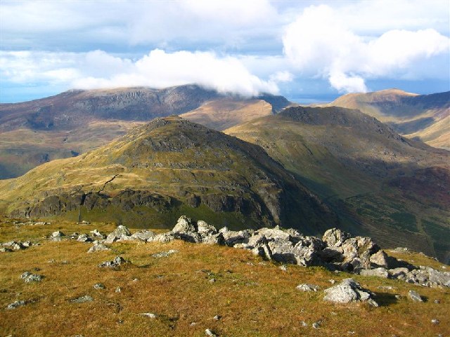
Description: Moel yr Ogof, Moel Lefn, and the Nantlle Ridge. Clouds drift across the distant Nantlle Ridge here viewed from the summit of Moel Hebog. The nearer summit is Moel yr Ogof, with Moel Lefn behind. The NW edge of Beddgelert Forest can just be seen on the right.
Title: Moel yr Ogof, Moel Lefn, and the Nantlle Ridge - geograph.org.uk - 72485
Credit: From geograph.org.uk
Author: David Crocker
Usage Terms: Creative Commons Attribution-Share Alike 2.0
License: CC BY-SA 2.0
License Link: https://creativecommons.org/licenses/by-sa/2.0
Attribution Required?: Yes
Image usage
The following page links to this image:

All content from Kiddle encyclopedia articles (including the article images and facts) can be freely used under Attribution-ShareAlike license, unless stated otherwise.