
Image: Montenegro venezia

Size of this preview: 525 × 599 pixels. Other resolutions: 210 × 240 pixels | 537 × 613 pixels.
Original image (537 × 613 pixels, file size: 56 KB, MIME type: image/png)
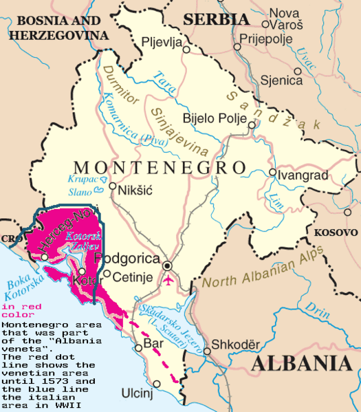
Description: Map of Montenegro showing the area of the "Albania veneta" and the italian area around Cattaro (Kotor) during WWII. Aree del Montenegro che fecero parte dell'Albania veneta (1420-1797) e del Regno d'Italia (1941-1943)
Title: Montenegro venezia
Credit: Image:Montenegro-un.png of Commons.wikimedia
Author: myself
Usage Terms: Public domain
License: Public domain
Attribution Required?: No
Image usage
The following page links to this image:

All content from Kiddle encyclopedia articles (including the article images and facts) can be freely used under Attribution-ShareAlike license, unless stated otherwise.