
Image: Moorefield West Virginia aerial view

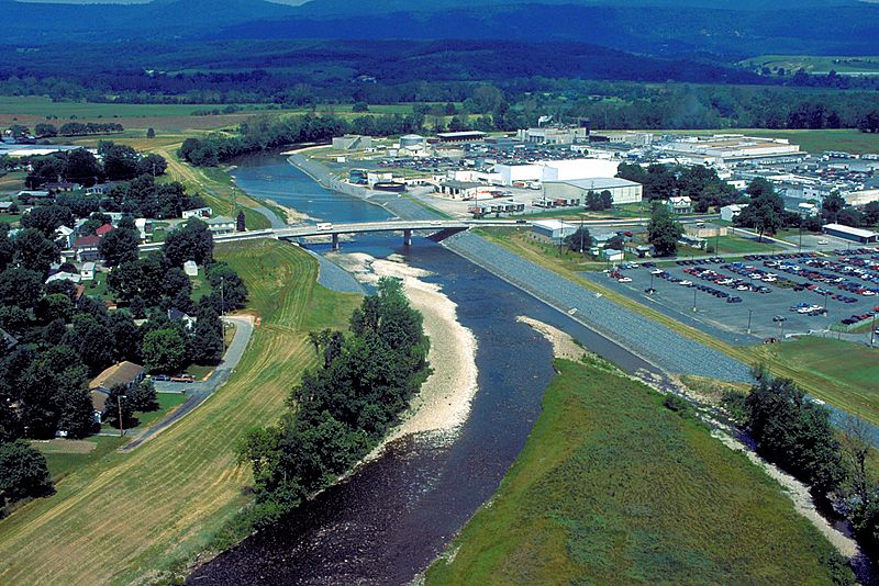
Description: Aerial view of the business section of Moorefield, West Virginia, USA. The South Fork South Branch of the Potomac River runs through the town.A bridge carrying U.S. Route 220 crosses the river. The U.S. Army Corps of Engineers has constructed levees and floodwalls along the river banks to protect the town. The view is downriver to the northwest.
Title: Moorefield West Virginia aerial view
Credit: U.S. Army Corps of Engineers Digital Visual Library Image page Image description page Digital Visual Library home page
Author: Tex Jobe, U.S. Army Corps of Engineers
Permission: This image or file is a work of a U.S. Army Corps of Engineers soldier or employee, taken or made as part of that person's official duties. As a work of the U.S. federal government, the image is in the public domain. English | italiano | Nederlands | русский | Türkçe | українська | +/−
Usage Terms: Public domain
License: Public domain
Attribution Required?: No
Image usage
The following page links to this image:
