
Image: Moro Sultanates (Philippines)
Size of this preview: 800 × 502 pixels. Other resolutions: 320 × 201 pixels | 1,539 × 966 pixels.
Original image (1,539 × 966 pixels, file size: 1.43 MB, MIME type: image/png)
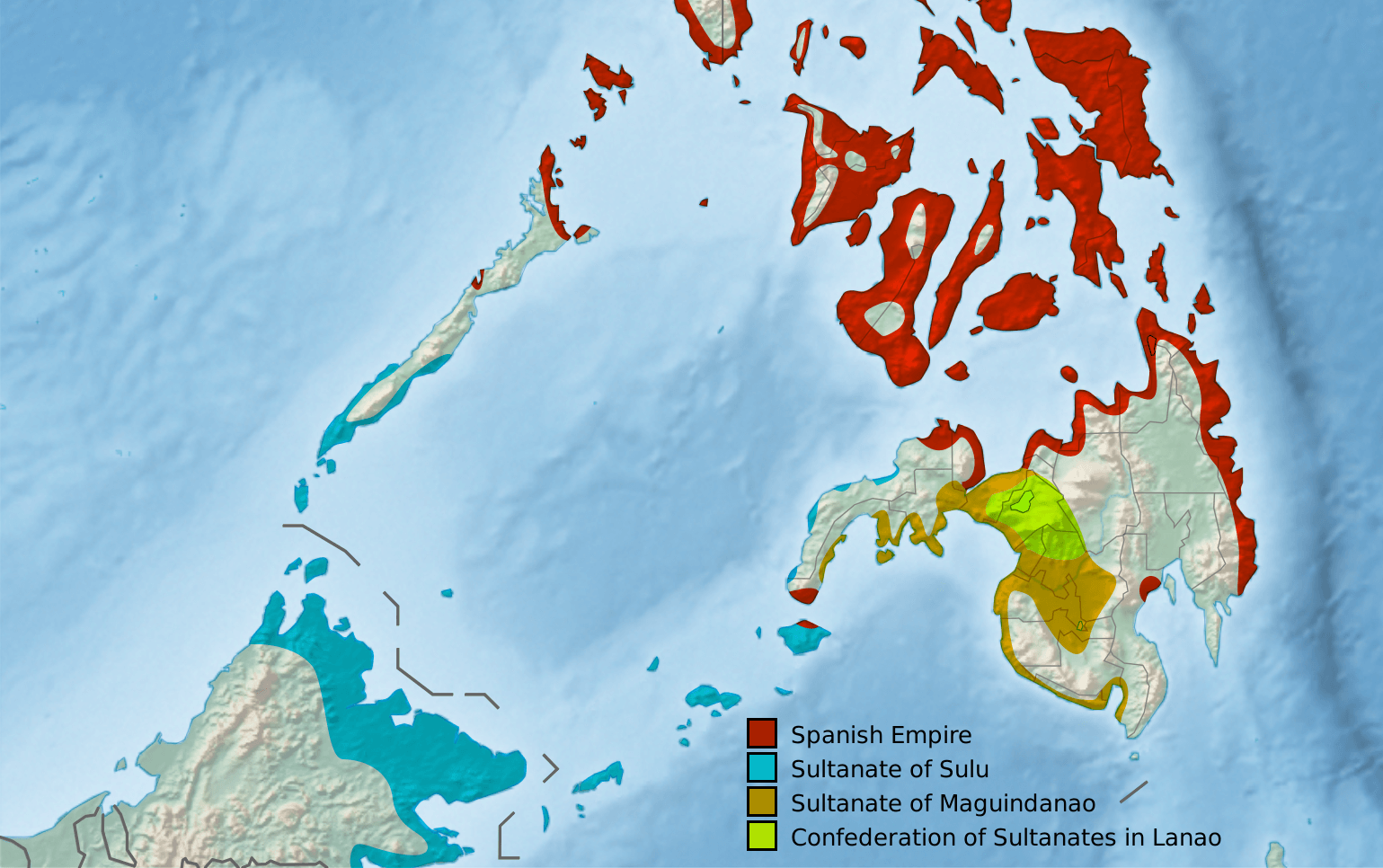
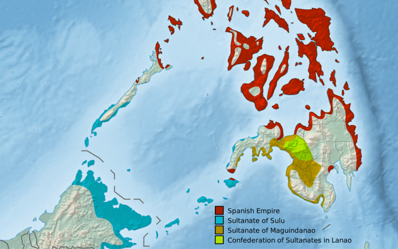
Description: Map of the approximate extents of the Moro Sultanates in Mindanao in the late 19th century, showing the Sultanate of Sulu, Sultanate of Maguindanao, and the Confederation of Sultanates of Lanao. Per Blumentritt, 1890
Title: Moro Sultanates (Philippines)
Credit: File:Philippines relief location map (square).svg
Author: User:Hellerick
Usage Terms: Creative Commons Attribution-Share Alike 4.0
License: CC BY-SA 4.0
License Link: https://creativecommons.org/licenses/by-sa/4.0
Attribution Required?: Yes
Image usage
The following 3 pages link to this image:

All content from Kiddle encyclopedia articles (including the article images and facts) can be freely used under Attribution-ShareAlike license, unless stated otherwise.
.png)