
Image: Mount Hood 2619s

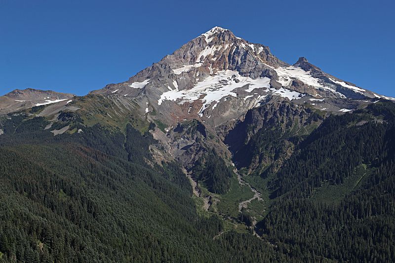
Description: Mount Hood with Sandy Glacier (center); Illumination Rock (9548 feet, right skyline) above Reid Glacier; Barrett Spur (7863 feet, left skyline); Yocum Ridge divides Reid and Sandy Glaciers; Sandy Glacier is the source of the Muddy Fork of Sandy River; stitched panorama; please see "Other versions" for source images.
This image was created with Hugin.
Viewpoint location: Bald Mountain Trail (unmaintained), Mount Hood Wilderness
Viewpoint elevation: 1408 meter (4618 ft)
View direction: 108°
Location source: Garmin GPSmap 60CSx
Location Datum: WGS84
Author: Walter Siegmund (talk)
Usage Terms: Creative Commons Attribution-Share Alike 3.0
License: CC-BY-SA-3.0
License Link: http://creativecommons.org/licenses/by-sa/3.0/
Attribution Required?: Yes
Image usage
The following 3 pages link to this image:
