
Image: NC Punt
No higher resolution available.
NC_Punt.jpg (400 × 400 pixels, file size: 77 KB, MIME type: image/jpeg)
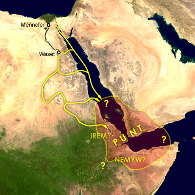
Description: Map of the supposed location of Punt and trade routes from Egypt to Punt via rivers, wadis, and by sea. Mennefer is Memphis, Waset is Thebes, Irem and Nemyw are lands that supposedly border on Punt
Title: NC Punt
Credit: Transferred from en.wikipedia to Commons.
Author: Cush at English Wikipedia
Usage Terms: Public domain
License: Public domain
Attribution Required?: No
Image usage
The following page links to this image:

All content from Kiddle encyclopedia articles (including the article images and facts) can be freely used under Attribution-ShareAlike license, unless stated otherwise.