
Image: NCbarrierislandsmap

Size of this preview: 369 × 599 pixels. Other resolutions: 148 × 240 pixels | 472 × 766 pixels.
Original image (472 × 766 pixels, file size: 17 KB, MIME type: image/png)
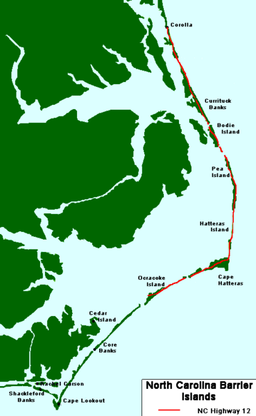
Description: A map of NC's barrier islands
Title: NCbarrierislandsmap
Credit: Own work by uploader modified from this NOAA file (archived from the original).
Author: Yohmom
Permission: NOAA files are public domain and see below for further permission.
Usage Terms: Creative Commons Attribution 3.0
License: CC BY 3.0
License Link: http://creativecommons.org/licenses/by/3.0
Attribution Required?: Yes
Image usage
The following 2 pages link to this image:

All content from Kiddle encyclopedia articles (including the article images and facts) can be freely used under Attribution-ShareAlike license, unless stated otherwise.