
Image: NPS jacob-riis-park-fishing-map

Size of this preview: 800 × 527 pixels. Other resolutions: 320 × 211 pixels | 1,980 × 1,305 pixels.
Original image (1,980 × 1,305 pixels, file size: 316 KB, MIME type: image/jpeg)
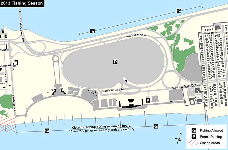
Description: This Jacob Riis Park fishing map shows the public fishing areas located on both the Rockaway Inlet side and Atlantic Ocean side of Jacob Riis Park near the very popular beach.
Title: NPS jacob-riis-park-fishing-map
Credit: U.S. National Park Service (http://npmaps.com/wp-content/uploads/jacob-riis-park-fishing-map.jpg)
Author: U.S. National Park Service, restoration/cleanup by Matt Holly
Usage Terms: Public domain
License: Public domain
Attribution Required?: No
Image usage
The following page links to this image:

All content from Kiddle encyclopedia articles (including the article images and facts) can be freely used under Attribution-ShareAlike license, unless stated otherwise.