
Image: NRHA 1

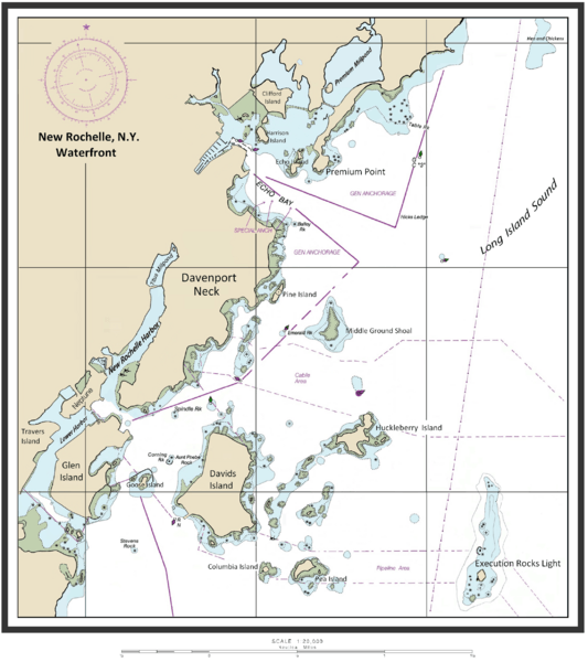
Description: Map of New Rochelle waterfront including the harbor management areas, islands, and inlets.
Title: NRHA 1
Credit: I (ClarckeBAR (talk)) created this work (custom map of New Rochelle Harbor Area with names/locations of geographic features, landforms). Underlying/base map data provided by The National Oceanic and Atmospheric Administration for use in nautical chart production. ( see print example (Western LIS) of published NOAA nautical chart). Main data source - The Seamless Raster Navigational Chart Server, under the following "Copyright Notice" - As required by 17 U.S.C. 403, third parties producing copyrighted works consisting predominantly of the material produced by U.S. government agencies must provide notice with such work(s) identifying the U.S. Government material incorporated and stating that such material is not subject to copyright protection within the United States. The information on government web pages is in the public domain and not subject to copyright protection within the United States unless specifically annotated otherwise (copyright may be held elsewhere). Foreign copyrights may apply.
Author: ClarckeBAR at English Wikipedia
Usage Terms: Creative Commons Attribution 3.0
License: CC BY 3.0
License Link: http://creativecommons.org/licenses/by/3.0
Attribution Required?: Yes
Image usage
The following 8 pages link to this image:
