
Image: NWCoast1a
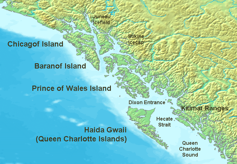
Description: Map of the coast of the Pacific Northwest --- Islands and major straits of the northern American pacific coast showing Prince of Wales Island (Alaska), Queen Charlotte Sound (Canada), Dixon Entrance, Hecate Strait, Baranof Island, Chichagof Island, Juneau Icefield, Stikine Icecap and other
Title: NWCoast1a
Credit: http://en.wikipedia.org/wiki/Image:NWCoast1a.png — — — This is adapted from a regional Topographic map made from GEMS data that is already posted on Wikimedia Commons. Original map created from DEMIS Mapserver, which are public domain.
Author: en:User:Koba-chan
Usage Terms: Creative Commons Attribution-Share Alike 3.0
License: CC-BY-SA-3.0
License Link: http://creativecommons.org/licenses/by-sa/3.0/
Attribution Required?: Yes
Image usage
The following 9 pages link to this image:
