
Image: Nanyue map
Size of this preview: 667 × 600 pixels. Other resolutions: 267 × 240 pixels | 791 × 711 pixels.
Original image (791 × 711 pixels, file size: 895 KB, MIME type: image/png)
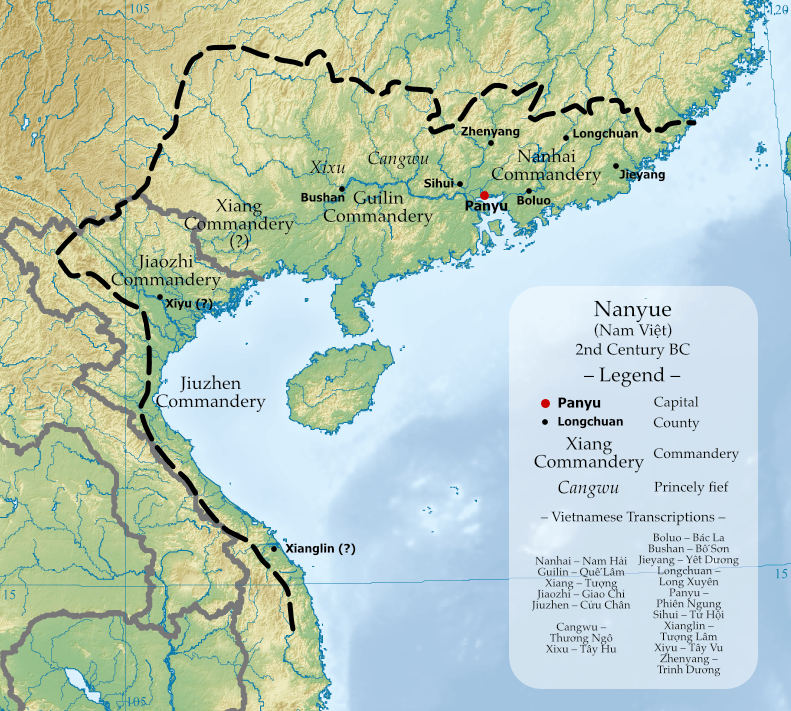
Description: Map of Nanyue Kingdom at its greatest territorial extent, with commanderies and known counties shown. Place names, locations and borders in this file are based on The Historical Atlas of China (中国历史地图集) by Tan Qixiang, and Administrative Geography during Western Han Dynasty (西汉政区地理) by Zhou Zhenhe. Base map is East Asia topographic map.png.
Title: Nanyue map
Credit: Own work
Author: Esiymbro
Usage Terms: Creative Commons Attribution-Share Alike 4.0
License: CC BY-SA 4.0
License Link: https://creativecommons.org/licenses/by-sa/4.0
Attribution Required?: Yes
Image usage
The following 2 pages link to this image:

All content from Kiddle encyclopedia articles (including the article images and facts) can be freely used under Attribution-ShareAlike license, unless stated otherwise.