
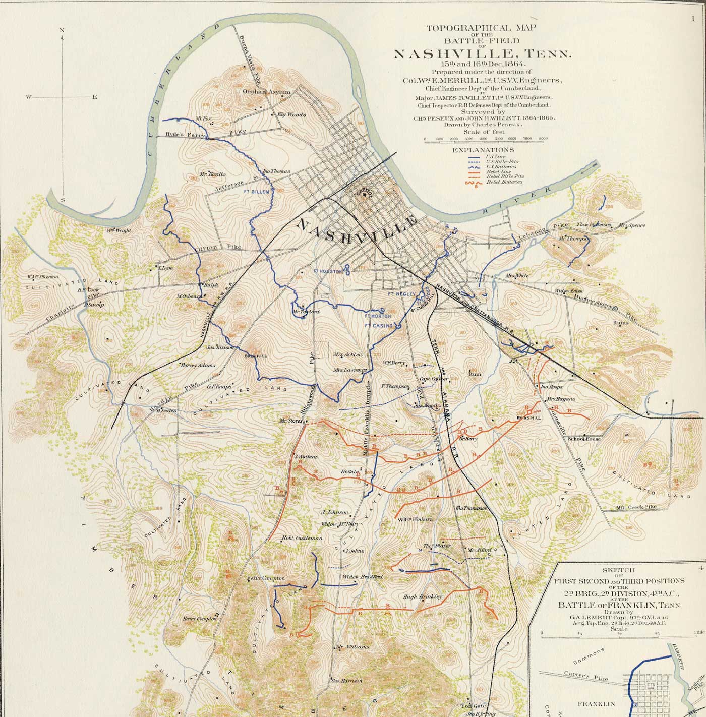
Image: Nashcivilwarmap
Size of this preview: 590 × 599 pixels. Other resolutions: 236 × 240 pixels | 1,400 × 1,422 pixels.
Original image (1,400 × 1,422 pixels, file size: 300 KB, MIME type: image/jpeg)
Description: Topographical map of Nashville and surrounding area made during the American Civil War. Drawn by Charles Peseux under the direction of Col. William E. Merrill, Chief Engineer, Department of the Cumberland.
Title: Nashcivilwarmap
Credit: Tennessee State Archives
Author: Charles Peseux
Usage Terms: Public domain
License: Public domain
Attribution Required?: No
Image usage
The following page links to this image:

All content from Kiddle encyclopedia articles (including the article images and facts) can be freely used under Attribution-ShareAlike license, unless stated otherwise.