
Image: National Atlas Louisiana closeup ESE
No higher resolution available.
National_Atlas_Louisiana_closeup_ESE.gif (245 × 300 pixels, file size: 28 KB, MIME type: image/gif)
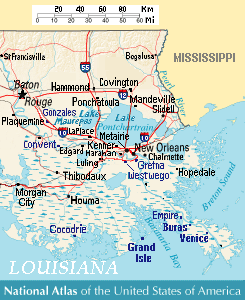
Description: Close view of east-southeast Louisiana (USA), showing areas of Baton Rouge, New Orleans, Metairie, Chalmette, Gretna, Westwego, Harahan, Luling, Kenner, LaPlace, Edgard, Convent, Slidell, Mandeville, Covington, Ponchatoula, Houma, Cocodrie, Buras, Venice, and Grand Isle, Louisiana. Lakes include: Lake Pontchartrain, Lake Maurepas (west), and Lake Salvador (south of Pontchartrain).
Title: National Atlas Louisiana closeup ESE
Credit: Except from National Atlas of the United States, with more towns labeled/clarified from reference road map.
Author: User:Wikid77 (derived from National Atlas)
Usage Terms: Public domain
License: Public domain
Attribution Required?: No
Image usage
The following 2 pages link to this image:

All content from Kiddle encyclopedia articles (including the article images and facts) can be freely used under Attribution-ShareAlike license, unless stated otherwise.