
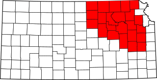
Image: National Weather Service Topeka, Kansas county warning area

Size of this PNG preview of this SVG file: 800 × 410 pixels. Other resolution: 320 × 164 pixels.
Original image (SVG file, nominally 6,607 × 3,388 pixels, file size: 28 KB)
Description: A map of the county warning area for the National Weather Service forecast office in Topeka, Kansas.
Title: National Weather Service Topeka, Kansas county warning area
Credit: Own work, derivative work of File:Map of Kansas highlighting Lincoln County.svg by User:David Benbennick
Author: Ks0stm
Usage Terms: Public domain
License: Public domain
Attribution Required?: No
Image usage
The following page links to this image:

All content from Kiddle encyclopedia articles (including the article images and facts) can be freely used under Attribution-ShareAlike license, unless stated otherwise.