
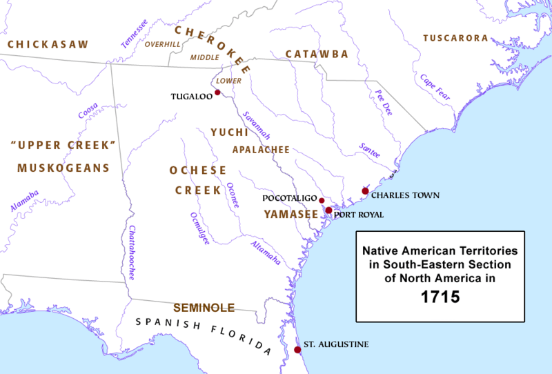
Image: Native American Territories, SE section, North America, 1715

Size of this preview: 800 × 542 pixels. Other resolutions: 320 × 217 pixels | 967 × 655 pixels.
Original image (967 × 655 pixels, file size: 135 KB, MIME type: image/png)
Description: This is an overview map of Native American territories in the South-Eastern area of North America in 1715.
Title: Native American Territories, SE section, North America, 1715
Credit: YamaseeWarMap01.png
Author: derivative work: Jdlambert YamaseeWarMap01.png: Pfly
Usage Terms: Creative Commons Attribution-Share Alike 3.0
License: CC BY-SA 3.0
License Link: http://creativecommons.org/licenses/by-sa/3.0
Attribution Required?: Yes
Image usage
The following 2 pages link to this image:

All content from Kiddle encyclopedia articles (including the article images and facts) can be freely used under Attribution-ShareAlike license, unless stated otherwise.