
Image: New England (1)

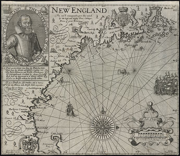
Description: Zoom into this map at maps.bpl.org. Author: Smith, John Publisher: Printed by Geor. Low Date: [1624] Location: New England Scale: Scale [ca. 1:1,120,000] Call Number: G3720 1624.S6 Based on John Smiths 1614 voyage along the New England coast, this is the first printed map devoted specifically to this region. It is also the first to use the name “New England”for an area that had up until this time been called “North Virginia.”Smith, who is more commonly associated with the founding of Virginia, was commissioned to survey the coastline north of New York in preparation for the settlement of another English colony. This map was used to guide the Pilgrims to Plymouth and also led John Winthrop to the Charles River in 1629.
Title: New England (1)
Credit: New England Uploaded by Gary Dee
Author: http://maps.bpl.org
Usage Terms: Creative Commons Attribution 2.0
License: CC BY 2.0
License Link: http://creativecommons.org/licenses/by/2.0
Attribution Required?: Yes
Image usage
The following 2 pages link to this image:

.jpg)