
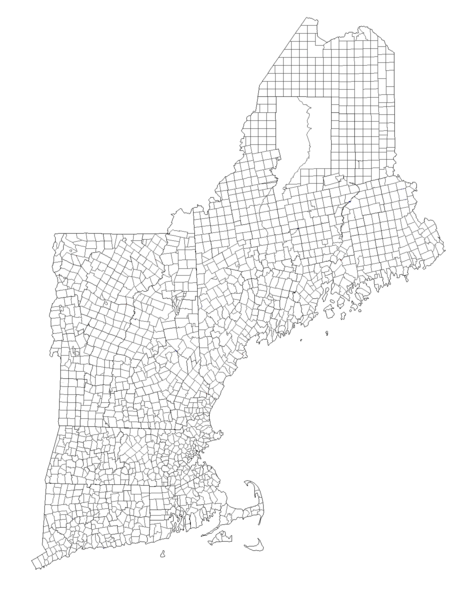
Image: New England Town Lines and Borders in the Six New England States

Size of this preview: 472 × 600 pixels. Other resolutions: 189 × 240 pixels | 1,180 × 1,500 pixels.
Original image (1,180 × 1,500 pixels, file size: 134 KB, MIME type: image/png)
Description: A blank map (PNG) showing the six New England states and their local (municipal) subdivisions.
Title: New England Town Lines and Borders in the Six New England States
Credit: Own work
Author: TimothyDexter
Usage Terms: Creative Commons Attribution-Share Alike 3.0
License: CC BY-SA 3.0
License Link: http://creativecommons.org/licenses/by-sa/3.0
Attribution Required?: Yes
Image usage
There are no pages that link to this image.

All content from Kiddle encyclopedia articles (including the article images and facts) can be freely used under Attribution-ShareAlike license, unless stated otherwise.