
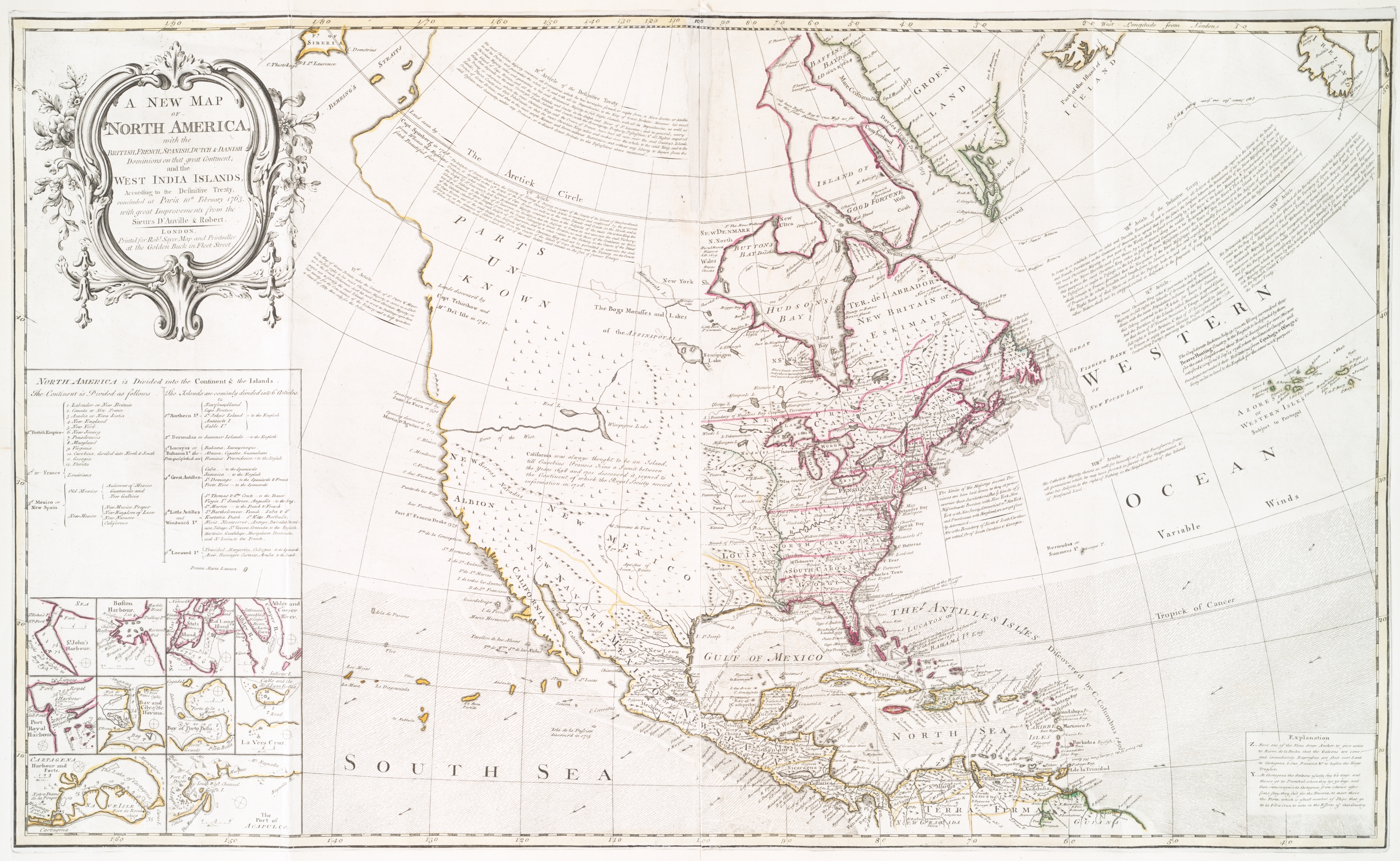
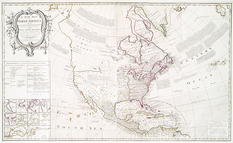
Image: New Map of North America (1763)
Description: Cropped and rotated version of a map already in Wikimedia Commons at File:A new map of North America - with the British, French, Spanish, Dutch & Danish dominions on that great continent, and the_West_India_Islands,_according_to_the_definitive_treaty_concluded_at_Paris_10th_NYPL434522.tiff
Title: New Map of North America (1763)
Credit: a file already in Wikimedia Commons (http://digitalgallery.nypl.org/nypldigital/dgkeysearchdetail.cfm?imageID=434522)
Author: Sayer, Robert, 1725-1794 -- Cartographer ;Anville, Jean Baptiste Bourguignon d', 1697-1782 -- CartographerRobert de Vaugondy, Didier, 1723-1786 -- Cartographer
Usage Terms: Public domain
License: Public domain
Attribution Required?: No
Image usage
The following 5 pages link to this image:

.JPG)