
Image: Newhavenrivers
No higher resolution available.
Newhavenrivers.png (500 × 500 pixels, file size: 43 KB, MIME type: image/png)
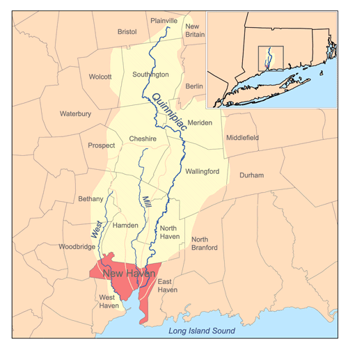
Description: This is a map of the rivers that flow though New Haven, Connecticut, namely the Quinnipiac, West, and Mill rivers and their associated watersheds. I, Karl Musser, created it based on USGS data, watershed boundaries are approximate. Township boundaries are from the State of Connecticut.
Title: Newhavenrivers
Credit: No machine-readable source provided. Own work assumed (based on copyright claims).
Author: No machine-readable author provided. Kmusser assumed (based on copyright claims).
Usage Terms: Creative Commons Attribution-Share Alike 2.5
License: CC BY-SA 2.5
License Link: http://creativecommons.org/licenses/by-sa/2.5
Attribution Required?: Yes
Image usage
The following 4 pages link to this image:

All content from Kiddle encyclopedia articles (including the article images and facts) can be freely used under Attribution-ShareAlike license, unless stated otherwise.