
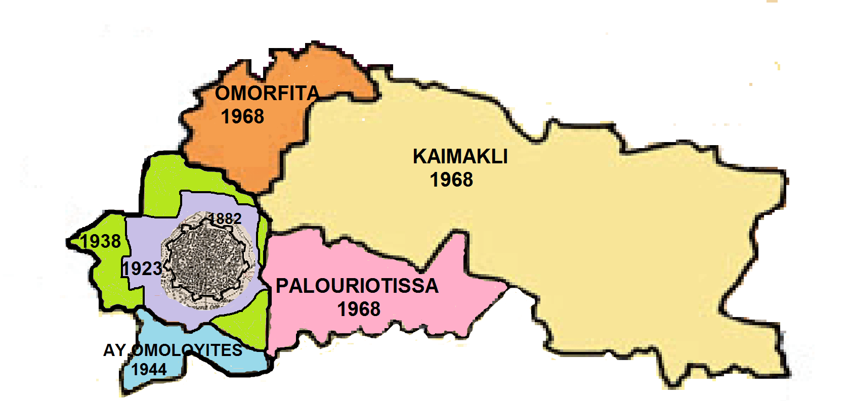
Image: Nicosia boundary extensions
Size of this preview: 800 × 377 pixels. Other resolutions: 320 × 151 pixels | 1,682 × 793 pixels.
Original image (1,682 × 793 pixels, file size: 142 KB, MIME type: image/png)
Description: Map showing the area of Nicosia municipality with extensions from 1882-1968
Title: Nicosia boundary extensions
Credit: This is a composite of small extracts from boundary maps already on Wikipedia overlain with boundary extension information taken from the Nicosia municipality web site (Aug 2013), Cyprus Gazette 1923 and "Nicosia" by K. Keshishian Previously published: Published here for the first time to accompany artiocle on Nicosia
Author: Tom1955
Usage Terms: Creative Commons Attribution-ShareAlike 3.0
License: CC-BY-SA-3.0
License Link: https://creativecommons.org/licenses/by-sa/3.0/
Attribution Required?: Yes
Image usage
The following page links to this image:

All content from Kiddle encyclopedia articles (including the article images and facts) can be freely used under Attribution-ShareAlike license, unless stated otherwise.