
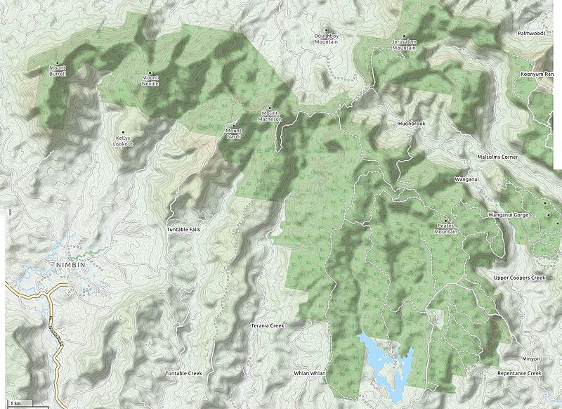
Image: Nightcap-range-openstreetmap
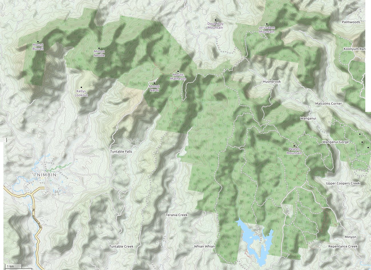
Size of this preview: 800 × 582 pixels. Other resolutions: 320 × 233 pixels | 1,300 × 946 pixels.
Original image (1,300 × 946 pixels, file size: 358 KB, MIME type: image/jpeg)
Description: The Nightcap Range (mountains) in northern New South Wales, Australia - map from OpenStreetMap, generated November 2019
Title: Nightcap-range-openstreetmap
Credit: Own work
Author: Tony 1212
Usage Terms: Creative Commons Attribution-Share Alike 4.0
License: CC BY-SA 4.0
License Link: https://creativecommons.org/licenses/by-sa/4.0
Attribution Required?: Yes
Image usage
The following 2 pages link to this image:

All content from Kiddle encyclopedia articles (including the article images and facts) can be freely used under Attribution-ShareAlike license, unless stated otherwise.