
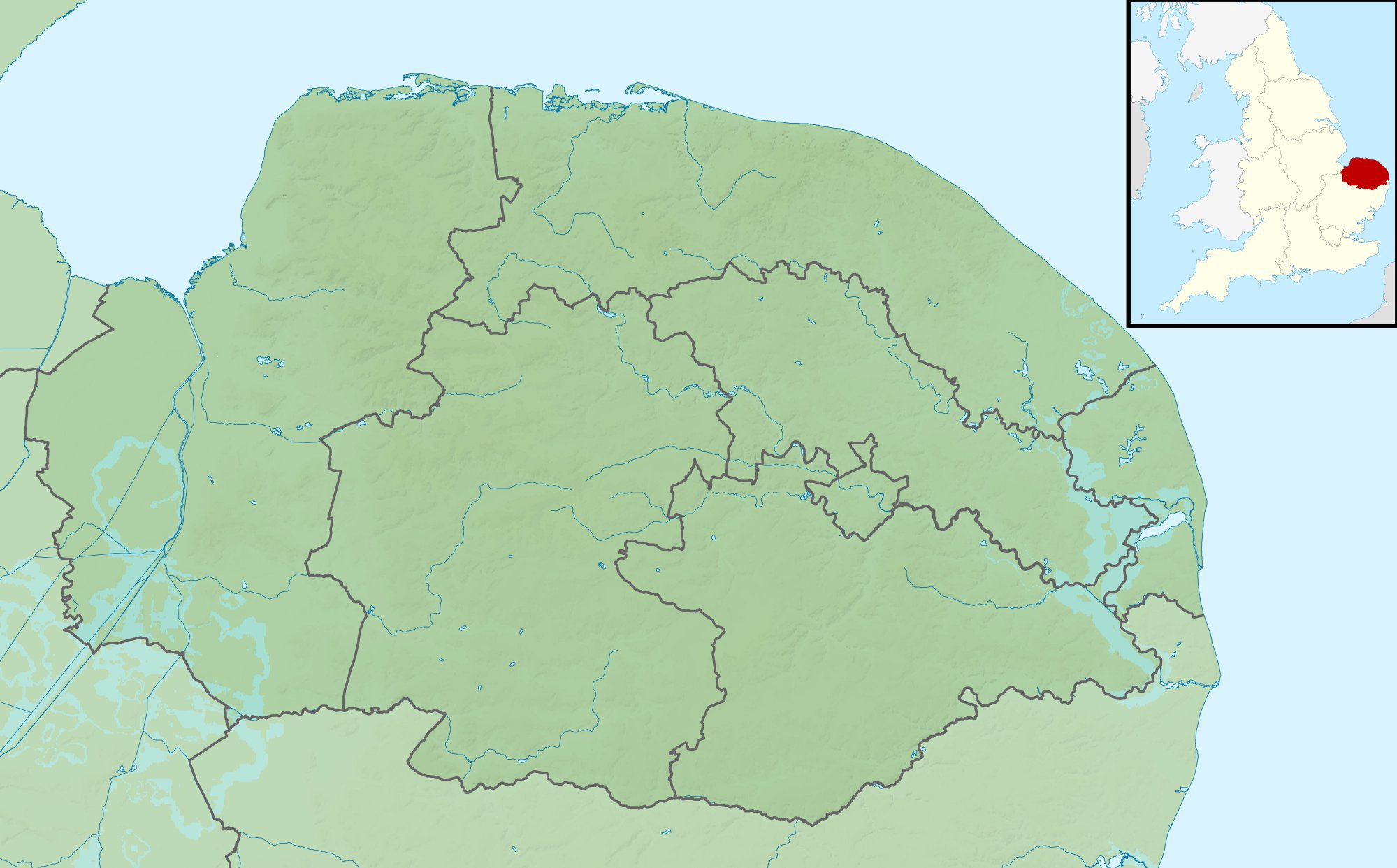
Image: Norfolk UK relief location map
Description: Relief map of Norfolk, UK. Equirectangular map projection on WGS 84 datum, with N/S stretched 160% Geographic limits: West: 0.12E East: 2.00E North: 53.05N South: 52.32N
Title: Norfolk UK relief location map
Credit: Ordnance Survey OpenData. Relief data from Land-Form Panorama product. Administrative borders and coastline data from Boundary-Line product. All other geographic data from Meridian 2 product. Inset derived from England location map.svg by Spischot.
Author: Nilfanion, created using Ordnance Survey data
Permission: This file is licensed under the Creative Commons Attribution-Share Alike 3.0 Unported license. Attribution: Contains Ordnance Survey data © Crown copyright and database right You are free: to share – to copy, distribute and transmit the work to remix – to adapt the work Under the following conditions: attribution – You must attribute the work in the manner specified by the author or licensor (but not in any way that suggests that they endorse you or your use of the work). share alike – If you alter, transform, or build upon this work, you may distribute the resulting work only under the same or similar license to this one. http://creativecommons.org/licenses/by-sa/3.0 CC BY-SA 3.0 Creative Commons Attribution-Share Alike 3.0 truetrue
Usage Terms: Creative Commons Attribution-Share Alike 3.0
License: CC BY-SA 3.0
License Link: http://creativecommons.org/licenses/by-sa/3.0
Attribution Required?: Yes
Image usage
The following 30 pages link to this image:
- Beacon Hill, Norfolk
- Beeston Beck (Norfolk)
- Fritton Lake
- Gaywood River
- Gur Beck
- Hagon Beck
- Heacham River
- Panford Beck
- River Ainse (or Eyn)
- River Ant
- River Burn, Norfolk
- River Chet
- River Cong (Norfolk)
- River Gadder
- River Glaven
- River Hor
- River Hun
- River Ingol
- River Mun
- River Stiffkey
- River Tas
- River Tat
- River Thet
- River Thurne
- River Tiffey
- River Tud
- River Wensum
- River Yare
- Scarrow Beck
- Template:Location map United Kingdom Norfolk
