
Image: NorthAmerica-WaterDivides
Size of this preview: 600 × 600 pixels. Other resolutions: 240 × 240 pixels | 900 × 900 pixels.
Original image (900 × 900 pixels, file size: 256 KB, MIME type: image/png)
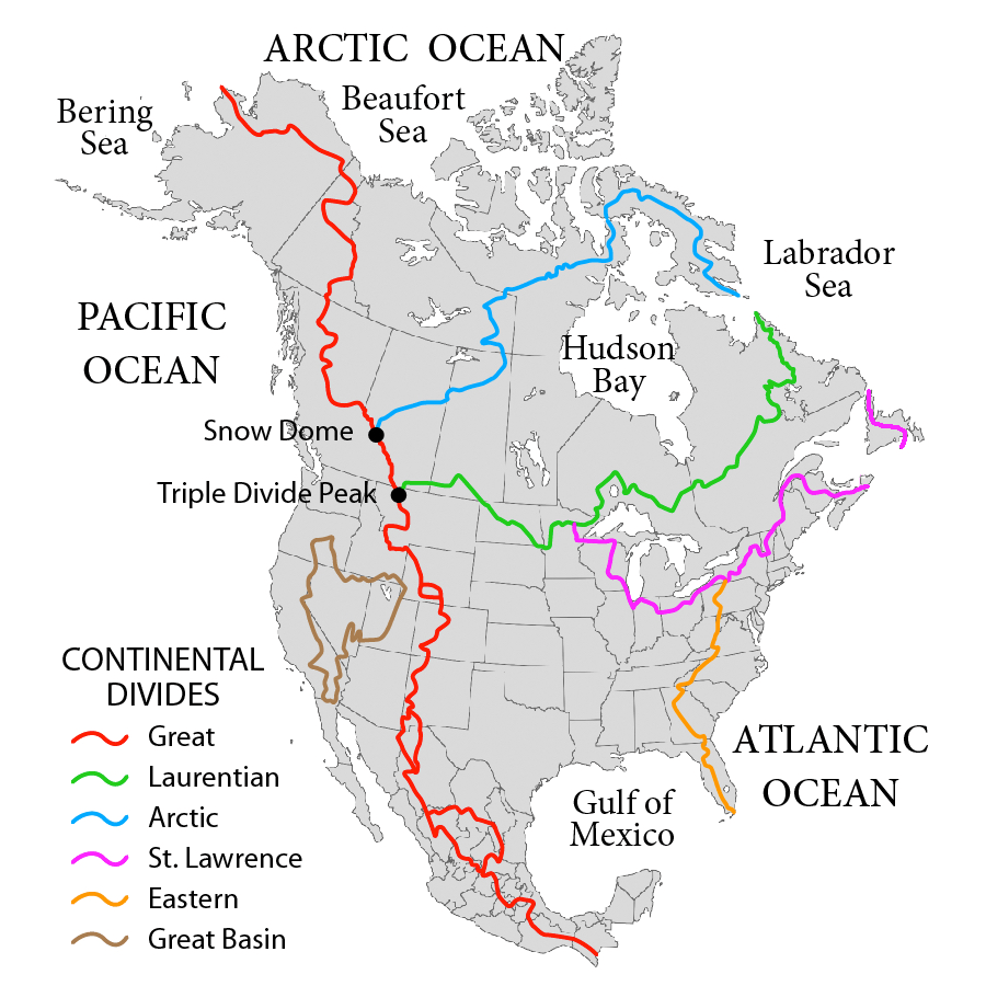
Description: Map showing the major Continental divides of North America, following the style of File:NorthAmericaDivides.gif and intended as a replacement. Made using File:BlankMap-North America-Subdivisions.svg as a base map. Various maps and other sources consulted, such as: File:Ocean drainage.png, Drainage Basins, The Atlas of Canada, http://www.cec.org/atlas/files/watersheds/na_watersheds_en.jpg, and others.
Title: NorthAmerica-WaterDivides
Credit: Own work
Author: Pfly
Usage Terms: Creative Commons Attribution-Share Alike 3.0
License: CC BY-SA 3.0
License Link: http://creativecommons.org/licenses/by-sa/3.0
Attribution Required?: Yes
Image usage
The following 15 pages link to this image:
- Canadian canoe routes
- Central United States
- Chicago Portage
- Continental Divide of the Americas
- Continental divide
- Great Divide Basin
- Hudson Bay drainage basin
- List of rivers of the Americas
- North America
- Pigeon River (Minnesota–Ontario)
- Royal Proclamation of 1763
- Rupert's Land
- Snow Dome (Canada)
- Triple Divide
- Triple Divide Peak (Montana)

All content from Kiddle encyclopedia articles (including the article images and facts) can be freely used under Attribution-ShareAlike license, unless stated otherwise.