
Image: Northplatterivermap
Size of this preview: 800 × 433 pixels. Other resolutions: 320 × 173 pixels | 1,460 × 791 pixels.
Original image (1,460 × 791 pixels, file size: 1.5 MB, MIME type: image/jpeg)
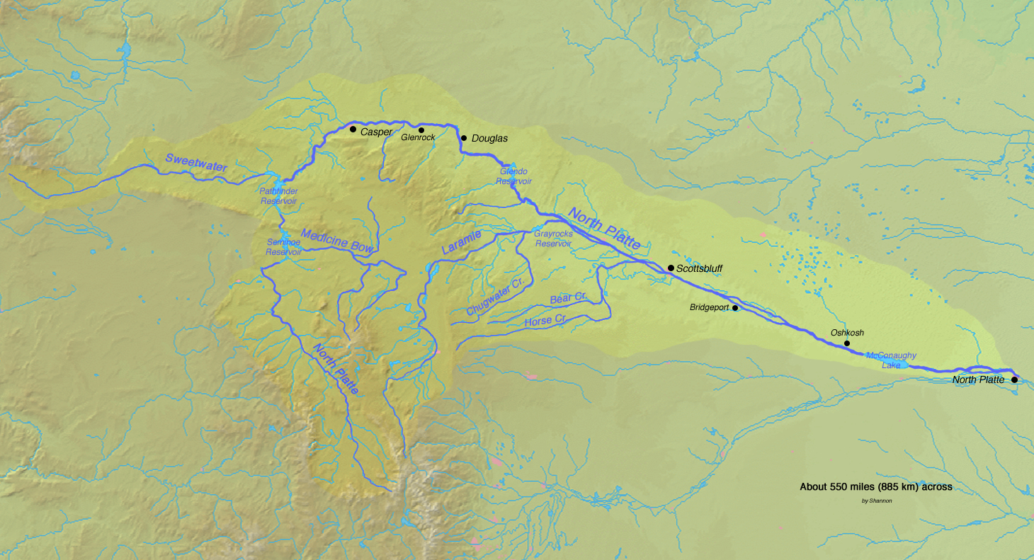
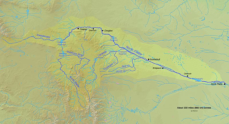
Description: Map of the North Platte River watershed in Colorado, Wyoming and Nebraska in the central USA
Title: Northplatterivermap
Credit: Background and river course data from http://www2.demis.nl/mapserver/mapper.asp
Author: Background layer attributed to DEMIS Mapserver, map created by Shannon1
Permission: Map created from DEMIS Mapserver, which are public domain.
Usage Terms: GNU Free Documentation License
License: GFDL
License Link: http://www.gnu.org/copyleft/fdl.html
Attribution Required?: Yes
Image usage
The following page links to this image:

All content from Kiddle encyclopedia articles (including the article images and facts) can be freely used under Attribution-ShareAlike license, unless stated otherwise.