
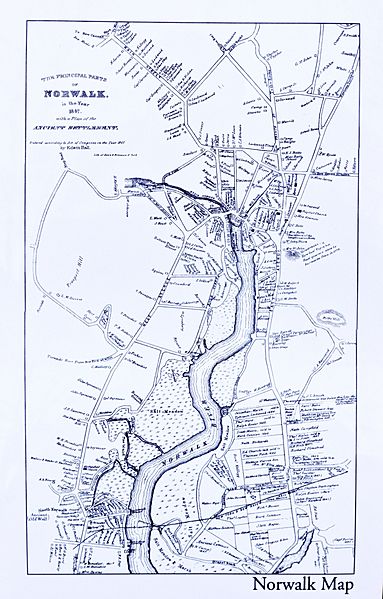
Image: Norwalk 1847 Map, CT, 06854, USA

Size of this preview: 383 × 599 pixels. Other resolutions: 153 × 240 pixels | 3,016 × 4,718 pixels.
Original image (3,016 × 4,718 pixels, file size: 3.2 MB, MIME type: image/jpeg)
Description: Norwalk 1847 Map, CT, 06854, USA. Title: The Principal Parts of Norwalk, in the Year 1847, with a Plan of the Ancient Settlement. Entered according to Act of Congress in the Year 1847 by Edwin Hall.
Title: Norwalk 1847 Map, CT, 06854, USA
Credit: Norwalk 1847 Map, CT, 06854, USA
Author: Edwin Hall
Usage Terms: Public domain
License: Public domain
Attribution Required?: No
Image usage
The following page links to this image:

All content from Kiddle encyclopedia articles (including the article images and facts) can be freely used under Attribution-ShareAlike license, unless stated otherwise.