
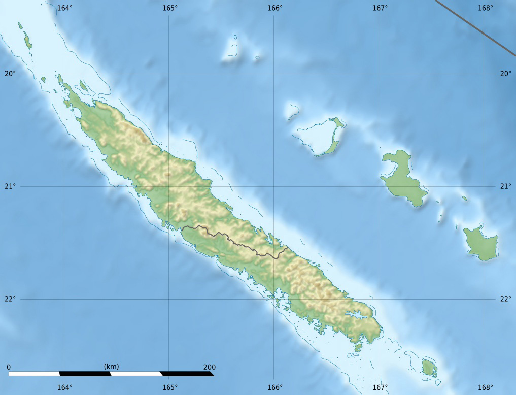
Image: Nouvelle-Calédonie collectivity relief location map centered
Description: Blank physical map of the territorial collectivity of New Caledonia, France, for geo-location purpose. This is a map centered on the main islands. For a general map allowing to geo-locate the remote islands, see below.
Title: Nouvelle-Calédonie collectivity relief location map centered
Credit: Own work Topography : NASA Shuttle Radar Topography Mission (SRTM3 v.2) (public domain) ; Bathymetry: NGDC ETOPO1 (public domain) ; Shorelines and reefs: NGDC GSHHS (public domain); NGDC WDBII (public domain); NGA PGS (public domain).
Author: Eric Gaba (Sting - fr:Sting)
Permission: Attribution and Share-Alike required Any use of this map can be made as long as you credit me (Eric Gaba – Wikimedia Commons user: Sting) as the author and distribute the copies and derivative works under the same license(s) that the one(s) stated below. A message with a reply address would also be greatly appreciated.
Usage Terms: Creative Commons Attribution-Share Alike 3.0
License: CC BY-SA 3.0
License Link: https://creativecommons.org/licenses/by-sa/3.0
Attribution Required?: Yes
Image usage
The following page links to this image:
