
Image: Nunivak 2000 USCGS

Size of this preview: 800 × 490 pixels. Other resolutions: 320 × 196 pixels | 897 × 549 pixels.
Original image (897 × 549 pixels, file size: 293 KB, MIME type: image/png)
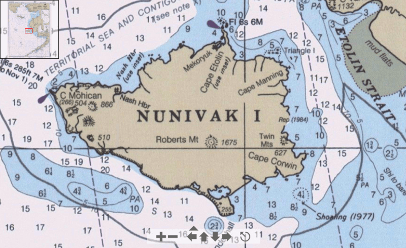
Description: Detail from Bering Sea nautical chart showing Nunivak Island and surrounding area.
Title: Nunivak 2000 USCGS
Credit: Historical Maps and Charts Project http://historicalcharts.noaa.gov/tiled_jpgs_done/zoomifyURLDrivenWebPage.htm?zoomifyImagePath=16006-12-2000
Author: Office of Coast Survey, NOAA, USA
Usage Terms: Public domain
License: Public domain
Attribution Required?: No
Image usage
The following 2 pages link to this image:

All content from Kiddle encyclopedia articles (including the article images and facts) can be freely used under Attribution-ShareAlike license, unless stated otherwise.